


,_Ras_Katy,_Sharm_el-Sheij,_Egipto,_2022-03-26,_DD_108.jpg)
Alaska Range
A south-central Alaskan mountain arc defined by active faulting, high massifs, glaciers, headwaters, and a Gulf-to-interior climate divide.
AlaskaGlaciersFaults
The Atlas Catalog is the direct browse surface for subject pages. It gathers mountains, rivers, deserts, lakes, reefs, and other natural places into a single reference index while preserving links back to broader terrain hubs.
Come here when you already know the kind of place you want, or when you want a fast scan of all records.
Terrain Index remains the broader category-first path through the atlas.
The catalog can carry both compact records and entry points into longer editorial features.
Short summaries and topic tags make the catalog readable at a glance without becoming visually noisy.
The catalog now separates terrain hubs from individual records so dense sections like mountains stay readable.
Dedicated sections keep broad browse pages visible while letting live mountain records sit under their own category.
Start here when you want the atlas by physical category rather than by one named place.
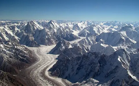 Mountain Hub
Browse mountain systems, peaks, high plateaus, and the growing archive of dedicated mountain records.
Image: Guilhem Vellut · CC BY-SA 2.0
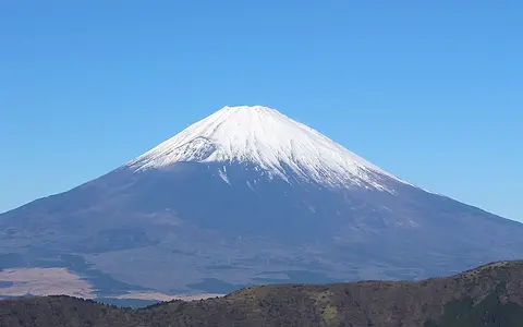 Volcano Hub
Browse volcanic peaks, shield volcanoes, calderas, lava fields, ash deposits, and island-arc terrain.
Image: Suicasmo · CC BY-SA 4.0
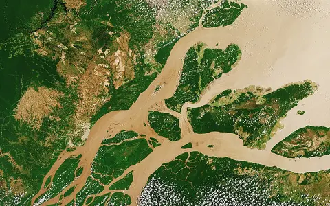 River Hub
A terrain path for drainage systems, headwaters, floodplains, deltas, and river-linked landscapes.
Image: ESA · CC BY-SA 3.0 IGO
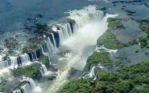 Waterfall Hub
Browse waterfall complexes, cataracts, gorge edges, plunge pools, escarpments, and river drops.
Image: Enaldo Valadares · CC BY-SA 3.0
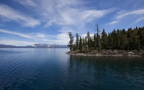 Lake Hub
Browse inland water bodies through basin form, shoreline structure, and freshwater geography.
Image: Lara Farhadi · CC BY 2.0
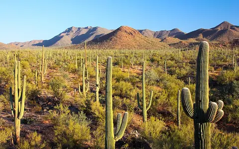 Desert Hub
Dryland browse pages for dune fields, stony deserts, plateaus, and arid transition landscapes.
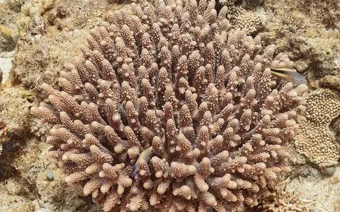 Reef Hub
Marine browse pages for coral reef systems, shallow-water shelves, and coastal habitat structures.
Image: Diego Delso · CC BY-SA 4.0
Individual mountain pages now live under the dedicated mountain category, grouped here for direct access.
A south-central Alaskan mountain arc defined by active faulting, high massifs, glaciers, headwaters, and a Gulf-to-interior climate divide.
A compact alpine arc built around glaciation, high valleys, passes, and European drainage divides.
An inner Asian highland system linking glaciated massifs, Ob and Irtysh headwaters, enclosed basins, and continental climate gradients.
A continental cordillera linking volcanic belts, plateaus, deserts, and major watershed divides.
A physical geography of the Apennine Mountains: range scope, Corno Grande elevation, fold-and-thrust structure, active extension, karst aquifers, glacial landforms, drainage, and climate controls.
An eastern North American range defined by old folds, long ridges, dissected plateaus, and divided drainage.
A North African mountain belt where Mediterranean climates meet interior basins and desert margins.
A southeastern European chain linking fold-and-thrust relief, Danube and Aegean drainage, cross-range gorges, and regional climate contrasts.
A northern Alaskan mountain system linking folded ridges, glacial valleys, permafrost, Arctic drainage, and an interior climate boundary.
A northern Iberian coastal range shaped by steep seaward relief, limestone karst, glacial landforms, divided drainage, and Atlantic climate controls.
A central and eastern European arc framing the Pannonian Basin, Danube tributaries, flysch ridges, and high massifs.
A Pacific-margin mountain belt shaped by subduction volcanism, glaciated relief, snow-fed rivers, and a pronounced eastern rain shadow.
A high-relief barrier between the Black and Caspian basins with glaciers and abrupt elevation change.
New Guinea's axial highland chain, linking collisional relief, intermontane valleys, island-scale river divides, equatorial rainfall, and glacial landforms.
A Pacific coastal system of granitic massifs, icefields, fjords, cross-range rivers, and a strong maritime-to-interior climate gradient.
A high Peruvian Andean range shaped by fault-bounded granite relief, tropical glaciers, glacial lakes, and Pacific-Amazon headwaters.
An Adriatic mountain system shaped by parallel limestone ridges, high karst plateaus, underground drainage, and maritime-continental climate contrasts.
A southern African escarpment and plateau-edge mountain system tied to highland runoff and cliffed relief.
Physical geography of the Eastern Ghats: range limits, Arma Konda elevation, relief sectors, metamorphic rocks, cross-range rivers, erosion, and monsoon controls.
The long eastern Australian upland system organizing escarpments, tablelands, and catchment divides.
High-relief terrain, glacial landscapes, monsoon contrasts, and major Asian river headwaters.
A high mountain system of deep valleys, divided drainage, glaciers, active relief, and links between Central and South Asian terrain.
A physical geography of Japan's Hida, Kiso, and Akaishi ranges: scope, measured summits, tectonic uplift, glacial landforms, snow climate, and drainage divides.
An extreme high-mountain region dominated by large glaciers, severe relief, and clustered very high peaks.
A northern Tibetan Plateau mountain system linking high massifs, glaciers, interior-basin headwaters, dry piedmonts, and active relief.
A high inner Asian mountain system linking sharp western relief, broad eastern basins, glaciers, divided drainage, and continental climate.
A Greek mainland mountain chain shaped by Hellenide structure, limestone and ophiolite massifs, divided drainage, former glaciation, and strong rainfall contrasts.
A northern Anatolian mountain system linking steep Black Sea slopes, complex Pontide geology, cross-range rivers, glacial highlands, and a strong interior rain shadow.
A Franco-Iberian range shaped by central high relief, Atlantic-Mediterranean climate transition, and strong drainage divides.
A North American upland spine connecting continental divides, alpine terrain, basins, and plateaus.
Physical geography of the Rwenzori Mountains: 5,109 m Margherita Peak, fault-block uplift, 2022 glacier extent, equatorial rainfall, and Nile drainage.
Physical geography of the Sayan Mountains: Western and Eastern Sayan extent, 3,491 m Mönkh Saridag, Yenisei drainage, geology, climate, permafrost, and glaciers.
A Nordic highland belt linking Caledonian structure, glacial plateaus, fjords, divided drainage, and a strong west-east climate gradient.
Physical geography of the Sierra Madre Occidental: its ~1,200 km extent, high ignimbrite plateau, faulted margins, deep river incision, drainage divides, and summer monsoon.
Physical geography of the Sierra Madre Oriental: its boundary-dependent extent, eight physiographic subprovinces, 3,709 m mapped high point, folded Mesozoic rocks, karst groundwater, drainage, and climate gradients.
A California range shaped by tilted-block relief, granite high country, snowpack, and a Great Basin rain shadow.
New Zealand's axial mountain range, shaped by Alpine Fault uplift, glacial relief, divided drainage, and a strong west-east rainfall contrast.
A southern Anatolian mountain system linking limestone massifs, karst drainage, Mediterranean slopes, plateau margins, and divided headwaters.
A Central Asian mountain system connecting high peaks, glaciers, dry basins, and source-region runoff.
An Antarctic range dividing East and West Antarctica, with rift-flank relief, outlet glaciers, and exposed dry valleys.
An ancient Eurasian range between major plains, with subdued relief, river divides, and strong continental climate controls.
Physical geography of the Verkhoyansk Range: its Lena-delta-to-Tompo extent, disputed summit elevation, fold-and-thrust geology, Lena–Yana–Omoloy drainage, permafrost landforms, and dated glacier change.
A western Indian plateau-edge range linking steep escarpments, monsoon rainfall, divided drainage, high southern massifs, and an interior rain shadow.
A Transbaikal watershed range linking fault-guided uplands with the Yenisei, Lena, and Amur drainage systems.
A Western Asian fold belt with parallel limestone ridges, Iranian Plateau margins, Mesopotamian drainage, and dryland transitions.
Individual volcano pages organized by cone form, eruption material, caldera structure, lava fields, and tectonic setting.
Explore Aconcagua through its high Andean massif, uplifted rock structure, arid relief, glacier-fed drainage, and position near the Argentina-Chile border.
An Ecuadorian volcano record with ice-capped summit slopes, crater structure, lahar channels, and Andean volcanic terrain.
Explore Eyjafjallajokull through its ice-capped stratovolcano form, summit caldera, outlet glaciers, meltwater drainage, maritime climate, and Icelandic rift setting.
A Hawaiian shield volcano record with summit caldera structure, rift zones, basalt lava flows, and coastal lava plains.
A Sunda Strait caldera record with explosive deposits, island remnants, volcanic rebuilding, and island-arc setting.
A Hawaiian shield volcano record with broad basalt slopes, rift zones, summit caldera structure, and ocean-island growth.
Explore Mount Agung through its steep Bali stratovolcano form, summit crater, radial ravines, lahar pathways, monsoon controls, and Sunda Arc setting.
Explore Mount Apo through its multi-edifice volcanic structure, broad three-peak summit, crater lake, radial watersheds, humid mountain climate, and Mindanao setting.
Explore Mount Ararat through its compound volcanic massif, twin cones, flank lava fields, summit ice, radial drainage, and Eastern Anatolian setting.
Explore Mount Baker through its andesite cone, summit craters, glaciers, Nooksack and Skagit drainage, lahar valleys, and North Cascades setting.
Explore Mount Bromo through its active pyroclastic cone, summit crater, Tengger caldera floor, ash deposits, monsoon controls, and East Java volcanic setting.
Explore Mount Cameroon through its steep coastal stratovolcano, fissure vents, cinder cones, basaltic lava fields, radial drainage, rainfall, and Cameroon Line setting.
Explore Mount Elbrus through its twin volcanic summits, broad lava-built massif, extensive glaciers, radial headwaters, and Greater Caucasus setting.
Explore Mount Erebus through its Ross Island stratovolcano form, summit caldera and crater, phonolite lava lake, glaciated flanks, and Antarctic rift setting.
A Sicilian volcano record with summit craters, flank vents, lava fields, ash deposits, and Mediterranean plate-margin context.
A Japanese volcanic cone record with symmetrical slopes, summit crater structure, lava and ash deposits, and island-arc context.
A southern Iceland stratovolcano record with an elongated summit fissure, lava-built flanks, groundwater drainage, maritime climate, and rift-transform context.
Explore Mount Hood through its andesite-dacite cone, glaciated summit, radial river valleys, lahar deposits, and Cascade arc setting in northern Oregon.
An Aleutian Range stratovolcano record with a lake-filled summit caldera, glacier-cut relief, radial meltwater drainage, and a 1912 collapse linked to Novarupta.
Explore Mount Kilimanjaro through its three-cone volcanic massif, Kibo caldera, steep relief, radial drainage, elevation climate, glaciers, and East African Rift setting.
An Albay stratovolcano record with a steep central cone, small summit crater, radial ravines, volcanic fans, tropical rainfall, and Philippine Trench context.
A Java volcano record with a summit lava dome, steep radial ravines, pyroclastic deposits, lahar pathways, and Sunda Arc context.
Explore Mount Nyiragongo through its steep Virunga cone, broad summit crater, lava terraces, fluid lava flows, highland climate, and East African Rift setting.
Explore Mount Pelée through its lava domes, collapse scarps, ravine-cut pyroclastic slopes, tropical drainage, and Lesser Antilles island-arc setting.
A Philippine volcano record with summit caldera collapse, crater lake setting, pyroclastic deposits, lahar valleys, and monsoon rainfall controls.
A glacier-covered Cascade volcano record with summit craters, lava layers, lahar valleys, and high-relief volcanic terrain.
Explore Mount Rinjani through its high Lombok summit, Segara Anak caldera and lake, Barujari cone, radial drainage, monsoon controls, and Sunda Arc setting.
Explore Mount Ruapehu through its multi-summit stratovolcano form, crater lake, glaciated slopes, radial headwaters, climate contrasts, and Taupō Volcanic Zone setting.
An East Java volcano record with the Mahameru summit, Jonggring-Seloko crater, a southeast-facing summit scar, radial valleys, monsoon drainage, and Tengger–Semeru context.
Explore Mount Shasta through its overlapping volcanic cones, glaciated summit, radial drainage, volcanic aprons, climate gradients, and Cascade arc setting.
A Cascade volcano record with crater breach, debris-avalanche terrain, ash deposits, lava dome growth, and arc context.
An Indonesian volcano record with a deep summit caldera, Sanggar Peninsula relief, pyroclastic deposits, radial drainage, and monsoon controls.
Explore Mount Unzen through its lava-dome complex, fault-bounded graben, dissected volcanic slopes, short river valleys, and Shimabara Peninsula setting.
A Campanian volcano record with cone and caldera structure, ash and pumice deposits, and Bay of Naples volcanic terrain.
Explore Mount Yasur through its scoria cone, summit crater, ash plain, Siwi caldera, tropical rainfall, drainage, and Vanuatu arc setting.
Explore Nevado del Ruiz through its broad stratovolcano form, Arenas crater, summit ice, radial river valleys, lahar pathways, and Colombian Andes setting.
Explore Ol Doinyo Lengai through its steep rift cone, twin summit craters, carbonatite lava, seasonal drainage, dry climate, and Lake Natron setting.
Explore Pico de Orizaba through Mexican stratovolcano form, summit crater structure, ash and lava deposits, lahar valleys, and Trans-Mexican Volcanic Belt geography.
Explore Piton de la Fournaise through its shield-volcano form, summit craters, Enclos Fouqué, Grandes Pentes, Grand Brûlé lava coast, drainage, climate, and Réunion setting.
A central Mexican volcano record with a summit crater, steep cone, ash and lava deposits, lahar valleys, and volcanic-belt context.
Explore Sakurajima through its overlapping volcanic cones, summit craters, radial drainage, lava-built coastline, and setting on the rim of Aira caldera.
A flooded caldera record with island-ring cliffs, pumice deposits, central volcanic islands, and Aegean arc geography.
Explore Stromboli through its island cone, crater terrace, Sciara del Fuoco, lava and tephra slopes, drainage, climate, and Aeolian arc setting.
Explore Taal Volcano through its lake-filled caldera, Volcano Island cones and craters, low relief, lake drainage, tropical rainfall, and Luzon arc setting.
Explore Teide through its summit cone, lava fields, Pico Viejo complex, Las Cañadas caldera setting, radial slopes, high-altitude climate, and Tenerife island geography.
Explore Yellowstone Caldera through its broad plateau basin, rhyolite flows, lake and river drainage, high-elevation climate, and North American hotspot setting.
Individual river pages organized by basin form, tributary structure, floodplain process, and outlet geography.
A basin-scale South American river record with Andean sources, large tributaries, floodplains, and an Atlantic outlet.
A northeast Asian river record with Shilka and Argun headwaters, monsoon floods, large tributaries, lowland wetlands, and a Sea of Okhotsk outlet.
A plateau-to-delta river record with Tibetan headwaters, an eastern Himalayan gorge reach, the Assam floodplain, and the Bengal delta.
A mountain-fed southwestern river record with snowmelt headwaters, plateau canyons, desert tributaries, reservoirs, and a Gulf of California outlet.
A central African river record with equatorial rainfall, large tributaries, lowland floodplains, lower-river rapids, and an Atlantic outlet.
A cross-European river record with Black Forest headwaters, basin transitions, gorge reaches, tributaries, and a Black Sea delta.
A plain-crossing eastern European river record with Valdai Hills headwaters, snowmelt flow, tributaries, reservoirs, and a Black Sea estuary.
A highland-to-estuary river record with Krkonoše headwaters, Bohemian basins, a sandstone gorge, lowland floodplains, and a tidal North Sea outlet.
A mountain-to-delta river record with Rocky Mountain headwaters, an Interior Plateau course, Fraser Canyon, snowmelt freshet, lower floodplain, and a Strait of Georgia outlet.
A South Asian river record with Himalayan headwaters, monsoon flow, Indo-Gangetic floodplains, and the Bengal delta.
A west-to-east Indian river record with Western Ghats headwaters, a Deccan Plateau course, major monsoon tributaries, and a Bay of Bengal delta.
A mountain-fed dryland river record with highland runoff, tributary plains, arid-basin flow, and an Arabian Sea outlet.
A mountain-to-lowland river record with Mongolian Altai headwaters, Lake Zaysan, Kazakhstan steppe reaches, major tributaries, seasonal ice, and an Ob confluence.
A northeast Siberian river record with upland headwaters, reservoir reaches, permafrost lowlands, snowmelt floods, major tributaries, and an East Siberian Sea delta.
A Siberian river record with Baikal-region headwaters, permafrost lowlands, seasonal ice, major tributaries, and a Laptev Sea delta.
A transboundary southern African river record with Marico–Crocodile headwaters, sandy border reaches, seasonal tributaries, Mozambique floodplains, and an Indian Ocean estuary.
A mountain-to-Atlantic river record with Massif Central headwaters, major tributaries, sandy floodplains, variable seasonal flow, and a tide-dominated estuary.
Explore the Mackenzie River through Great Slave Lake, northern tributaries, the Mackenzie Valley, seasonal ice, permafrost terrain, and its Beaufort Sea delta.
Explore the Madeira River from Andean headwaters through the Beni–Mamoré confluence, rapid and reservoir reaches, Amazon lowlands, and its sediment-rich outlet.
Explore the Magdalena River from Colombian Massif headwaters through inter-Andean valleys, the Mompox floodplain, and its Caribbean Sea outlet.
A mainland Southeast Asian river record with plateau sources, seasonal flood pulses, Tonle Sap storage, and delta distributaries.
A continental interior river record with major tributary junctions, alluvial floodplains, seasonal flow, and a Gulf outlet.
An Australian river-system record with variable flow, dryland tributaries, lowland floodplains, wetlands, and a southern coastal outlet.
A lake-fed northern Manitoba river record with Lake Winnipeg outflow, Shield lake basins and rapids, regulated discharge, seasonal ice, and a Hudson Bay outlet.
A West African river record with Guinea Highland sources, a great inland arc, Inner Niger Delta floodplains, Sahelian flow, and a Gulf of Guinea delta.
A long north-flowing drainage record built around source regions, floodplain corridors, confluences, and delta structure.
A western Siberian river record with Altai headwaters, the Ob-Irtysh network, floodplain wetlands, seasonal ice, and a Kara Sea outlet.
An endorheic southern African river record with Angolan plateau headwaters, contrasting Cubango and Cuito tributaries, a Kavango border reach, and an inland delta in Botswana.
A west-flowing southern African river record with Lesotho Highland headwaters, the Vaal confluence, plateau reservoirs, Augrabies gorge, desert reaches, and an Atlantic estuary.
A northern South American river record with shield margins, savanna floodplains, seasonal wetlands, and an Atlantic delta.
A South American river record with plateau tributaries, falls-linked reaches, reservoirs, floodplain wetlands, and a Rio de la Plata outlet.
An Alpine-fed river record with Monte Viso headwaters, Alps–Apennines tributaries, a broad alluvial plain, seasonal flow, and an Adriatic delta.
Explore the Purus River from its Peruvian headwaters across the western Amazon lowlands, with its meanders, floodplain lakes, tributaries, and Solimões confluence.
A European river record with Alpine headwaters, rift-valley reaches, tributaries, floodplain corridors, and a North Sea delta.
Explore the Rio Grande through Rocky Mountain headwaters, rift valleys, desert basins, canyon reaches, tributaries, and its Gulf of Mexico outlet.
A Great Lakes–Atlantic river record with lake-regulated flow, glacial lowlands, Shield tributaries, seasonal ice, and a tidal estuary.
A plateau-to-estuary river record with Nu Jiang headwaters, Yunnan and Myanmar gorges, monsoon tributaries, and a Gulf of Mottama outlet.
Explore the Senegal River from Fouta Djallon headwaters and the Bafing–Bakoye confluence through its Sahelian valley, floodplain, delta, and Atlantic outlet.
A Tien Shan-fed river record with the Naryn and Kara Darya, the Fergana Valley, regulated dryland reaches, and a North Aral Sea outlet.
Explore the Tagus River through Iberian headwaters, plateau valleys, tributaries, seasonal flow, reservoir reaches, and its broad Atlantic estuary.
A western Asian paired-river record with mountain headwaters, arid plains, Mesopotamian marshes, and the Shatt al-Arab outlet.
Explore the Tocantins River from the Goiás highlands through plateau valleys, the Araguaia confluence, Tucuruí reservoir, and the tidal Pará estuary.
A subtropical South American river record with Serra Geral headwaters, basalt valleys, transboundary reaches, seasonal flow, reservoirs, and a Rio de la Plata outlet.
Explore the Vistula River through Beskid headwaters, Polish basins and lowlands, Carpathian tributaries, seasonal flow, the Żuławy delta, and the Baltic Sea outlet.
A Russian interior river record with upland sources, broad tributary plains, seasonal flow, reservoirs, and a Caspian Sea delta.
A plateau-to-coast river record with Tibetan headwaters, gorge reaches, monsoon hydrology, floodplain lakes, and a sea outlet.
A northern Chinese river record with plateau headwaters, the Ordos Loop, loess sediment, alluvial plains, and a Bohai Sea outlet.
Explore the Yenisei River through Sayan headwaters, Siberian plateau tributaries, snowmelt floods, seasonal ice, and its Kara Sea outlet.
Explore the Yukon River through mountain headwaters, interior plateaus and lowlands, major tributaries, seasonal ice, permafrost terrain, and its Bering Sea delta.
A plateau river record with tributary basins, Victoria Falls, gorge reaches, reservoirs, floodplains, and an Indian Ocean outlet.
Individual waterfall pages organized by river drop, bedrock edge, plunge-pool process, gorge incision, and basin context.
A Hawaiʻi Island waterfall record with rainfall-fed flow, a tall single plunge, volcanic gorge relief, and a short Pacific-draining stream.
A tepui-edge waterfall record with sandstone cliffs, free-falling water, spray dispersal, plunge zones, and Orinoco basin context.
An Orange River waterfall record with a 56-metre drop, ancient gneiss, fault-guided erosion, flood pulses, and semi-arid gorge terrain.
A limestone waterfall record with stepped river drops, karst channels, plunge pools, and border-river geography.
An upper Abay River waterfall record with Lake Tana outflow, volcanic rock, rainy-season discharge, gorge incision, and Nile basin context.
Explore Browne Falls through Lake Browne outflow, long cascades, glacial fiord relief, heavy rainfall, and the Doubtful Sound/Patea setting.
Explore Burney Falls through spring-fed flow, layered basalt, volcanic aquifers, gorge retreat, and its connection to the Pit and Sacramento river basins.
Explore Chitrakote Falls through its 29-metre drop, broad sandstone brink, Indravati River flow, monsoon discharge, and Godavari basin connection.
An Icelandic waterfall record with glacial river discharge, basalt canyon walls, plunge-pool erosion, spray zones, and volcanic terrain.
A Western Ghats waterfall record with monsoon flow, steep escarpment relief, forested gorge slopes, and seasonal runoff.
Explore Epupa Falls through Kunene River flow, a 1.5-kilometre cascade reach, ancient gneiss, divided channels, seasonal floods, and arid border terrain.
Explore Erawan Falls through its seven limestone tiers, carbonate pools, Huai Mong Lai flow, monsoon seasonality, and Khwae Yai basin setting in Thailand.
A central Pyrenean waterfall record with an approximately 422-metre descent, stepped limestone cirque relief, snowmelt-influenced flow, and Gave de Pau–Adour drainage.
A northern Peruvian Andes waterfall record with two major drops, calcareous mountain relief, seasonal rainfall, and Utcubamba basin drainage.
A stepped waterfall record with glacial runoff, basalt canyon incision, spray zones, and Icelandic highland drainage.
A northern Arizona waterfall record with spring-fed flow, an actively changing travertine ledge, deep canyon relief, flash floods, and Colorado River drainage.
Explore Huangguoshu Waterfall through the Baishui River, Guizhou Plateau karst, a broad 77.8-metre drop, monsoon flow, gorge retreat, and Pearl River drainage.
A broad cataract complex with basalt steps, cataract islands, plunge pools, gorge retreat, spray forest, and Parana basin links.
Explore Jim Jim Falls through its 200-metre Arnhem Land escarpment drop, sandstone gorge, monsoonal flow, plunge pool, and South Alligator River drainage.
A Western Ghats waterfall record with monsoon discharge, segmented drops, plunge pools, and Sharavathi River flow.
A Guiana Shield waterfall record with sandstone cliffs, single-drop flow, plunge-pool erosion, rainforest spray zones, and Potaro drainage.
Explore Kalambo Falls through its 221-metre drop, Tanganyika Rift escarpment, seasonal river flow, upstream basin, gorge, and Lake Tanganyika drainage.
A Lucala River waterfall record with a broad curved crest, a roughly 105-metre drop, seasonal discharge, confined valley relief, and Kwanza basin drainage.
Explore Kegon Falls through its 97-metre plunge, Lake Chuzenji outflow, layered volcanic cliff, groundwater-fed side falls, managed discharge, and Tone basin connection.
Explore Krimml Waterfalls through their 380-metre, three-stage descent, glacial-valley relief, Krimmler Ache flow, Alpine meltwater, and Salzach drainage.
A northern Laos waterfall record with a roughly 60-metre main drop, carbonate-rimmed pools, monsoon-fed flow, and Mekong basin context.
A central Lesotho waterfall record with a 192-metre single drop, layered Jurassic basalt, a fracture-controlled brink, seasonal highland flow, and Senqu–Orange drainage.
Explore Mardalsfossen through its 705-metre descent, 297-metre free fall, glacial valley relief, regulated mountain runoff, and Eikesdalsvatnet drainage.
An Oregon waterfall record with a 620-foot two-tier descent, layered basalt cliffs, hanging-valley relief, rain-and-snow-fed flow, and Columbia River drainage.
A northwestern Uganda waterfall record with a narrow gneiss cleft, a roughly 43–45-metre drop, Albertine Rift relief, lake-buffered flow, and Lake Albert drainage.
Explore Nachi Falls through its 133-metre plunge, igneous-rock escarpment, forested mountain catchment, heavy Pacific rainfall, and Nachi River connection.
A Great Lakes waterfall record with escarpment retreat, cataract flow, plunge pools, gorge formation, and Niagara River drainage.
Explore Nohkalikai Falls through its 340-metre plunge, Sohra Plateau rim, monsoon-fed stream, layered rock, plunge pool, and south-facing Khasi escarpment.
Explore Ouzoud Falls through its 110-metre tiered drop, Jurassic limestone, Central High Atlas relief, seasonal runoff, and Oum Er-Rbia basin setting.
A Croatian karst waterfall record with tufa barriers, terraced lakes, limestone canyon relief, dolomite basins, and Korana drainage.
A Swiss High Rhine waterfall record with limestone bedrock, glacially shifted channels, seasonal discharge, plunge-zone erosion, and Rhine basin context.
Explore Seljalandsfoss through its 60-metre plunge, volcanic cliff, recessed rock face, maritime runoff, and south Iceland coastal-plain setting.
A basalt plateau waterfall record with Snake River canyon incision, plunge pools, seasonal flow, and western dryland terrain.
A Skoga River waterfall record with a broad 60-metre plunge, layered volcanic rock, former sea-cliff relief, maritime runoff, and a southern coastal-plain setting.
A glacial landscape waterfall record with hanging-valley relief, lake outflow, multi-stage drops, forested slopes, and Fiordland terrain.
A Colombian Eastern Cordillera waterfall record with an approximately 157-metre drop, a high-basin outlet, sedimentary-rock gorge, regulated Bogotá River flow, and Magdalena drainage.
Explore Thi Lo Su Waterfall through its broad limestone face, segmented drops, monsoon-fed flow, rugged upland setting, and western Thailand drainage context.
A Drakensberg waterfall record with escarpment cliffs, seasonal highland runoff, plunge zones, and southern African terrain.
A Zambezi River waterfall record shaped by basalt fractures, spray zones, plunge pools, gorge incision, and plateau flow.
Explore Vøringsfossen through its 182-metre fall, Hardangervidda plateau edge, Måbødalen gorge, regulated Bjoreio flow, and Hardangerfjord drainage.
A northern Queensland waterfall record with a 268-metre Stony Creek plunge, hanging-tributary relief, permanent Wet Tropics flow, and Herbert River drainage.
An eastern Ghana waterfall record with an approximately 80-metre drop, Akwapim-Togo escarpment relief, variable perennial flow, and Dayi-Volta drainage.
A Sierra Nevada waterfall record with granite cliffs, glacial valley form, seasonal snowmelt, plunge pools, and talus slopes.
A northern Peruvian Andes waterfall record with an 895.4-metre four-stage descent, a cave-fed headwater, steep elongated basin relief, seasonal rainfall, and Utcubamba drainage.
Individual lake pages organized by basin geometry, shoreline structure, inflow and outflow, climate setting, and regional drainage links.
A Central Asian terminal-basin record with split remnant waters, Amu Darya and Syr Darya inflow, exposed lakebed, salinity, and arid climate controls.
An enclosed inland-sea record with shallow shelves, deeper basins, major river inflows, brackish water, evaporation, and Caspian climate controls.
Physical geography of the Dead Sea: its active northern lake, dated surface level and area, pull-apart basin, Jordan drainage, hypersaline water, evaporation, and retreating shore.
A northern Canadian freshwater record with glacial basin form, long arms, Shield margins, Great Bear River outflow, ice cover, and Mackenzie drainage links.
A Great Basin terminal-lake record with shallow basin form, variable shoreline, river inflows, evaporation, salinity, and causeway-divided arms.
A Northwest Territories freshwater record with a broad shallow western basin, deep bedrock-controlled East Arm, Slave River inflow, Mackenzie River outflow, and subarctic ice controls.
A measured physical-geography guide to Kati Thanda–Lake Eyre: two playa basins, a 9,500 km² mapped footprint, a −15 m AHD floor, desert-river inflow, salt and flood variability.
Lake Albert atlas record: Uganda–DR Congo setting, 2019 shoreline, 2020 bathymetry, Albertine Rift structure, Semliki and Victoria Nile inflows, and Albert Nile outlet.
Physical geography of Lake Athabasca: its Alberta–Saskatchewan setting, approximately 7,900 km² surface, sparse bathymetry, deltas, drainage, geology, dunes, ice, and variable water level.
A major inland-water record joining exceptional depth, shoreline form, freshwater scale, and cold-region basin context.
A Kazakhstan basin-lake record with elongated shallow form, Ili River inflow, divided freshwater and saline waters, evaporation, and Balkhash-Alakol drainage links.
A shallow Sahel lake record with closed-basin setting, variable open water, reed wetlands, Chari-Logone inflow, evaporation, and climate controls.
A Lombardy lake record with a branching glacially reshaped basin, steep mountain shores, 425-metre depth, Adda and Mera inflows, the Lecco outlet, and Alpine climate controls.
A northern Alpine foreland lake record with a deep Obersee, shallow island-divided Untersee, Seerhein connection, Alpine Rhine inflow, High Rhine outflow, and snowmelt-driven water levels.
A lower Great Lakes record with shallow basin form, western islands, tributary inflow, Niagara River outflow, and lake-effect climate controls.
A northern Italian lake record with a deep glacial trough, broad southern foreland basin, Sarca inflow, Mincio outflow, contrasting shoreline relief, and channelled local winds.
Physical geography of Lake Geneva (Léman): its 580.1 km² transboundary basin, 309.7 m maximum depth, Rhône inflow and outlet, glacial history, sediment plume, regulated level, and deep-water mixing.
A central Great Lakes record with glacial basin form, Georgian Bay, island structure, St. Marys inflow, St. Clair outflow, and lake-effect climate controls.
Physical geography of Lake Issyk-Kul: mapped depth and dimensions, Tian Shan basin formation, closed drainage, former Chu connection, climate gradient, mixing, and measured level change.
A Rwanda–DR Congo lake record with a segmented rift basin, volcanic shores, permanent deep-water layering, highland inflows, Ruzizi outflow, and Congo drainage links.
A northwest Russian freshwater record with glacial basin form, northern skerry shores, Svir, Volkhov, and Vuoksi inflows, Neva outflow, and Baltic drainage links.
A southern East African Rift lake record with long basin form, steep escarpment-backed shores, Ruhuhu inflow, Shire outflow, and Zambezi drainage links.
Physical geography of Lake Maracaibo: shallow bathymetry, Catatumbo drainage, the Strait and Tablazo Bay outlet, salt layering, basin geology, and nocturnal storms.
A central Great Lakes record with deep glacial basins, dune and bluff shores, tributary inflows, Straits of Mackinac exchange, and lake-effect climate controls.
A sourced physical geography of Lake Mweru: its 5,120 km² surveyed surface, shallow fault-bounded basin, Luapula inflow, Luvua outflow, and seasonal levels.
Physical geography of Lake Nasser and Lake Nubia: naming scope, coordinates, stage-dependent area and depth, drowned Nile valleys, khors, sediment, evaporation, and regulated outflow.
A sourced physical geography of Lake Nicaragua (Cocibolca): names, location, basin extent, disputed depth, volcanic landforms, water balance, and San Juan River outlet.
A south-central Florida freshwater record with a broad shallow basin, marsh-fringed shores, Kissimmee River inflow, wet-and-dry season water levels, managed outlets, and Greater Everglades connections.
Physical geography of Lake Onega: its measured basin, shield-to-platform geology, tributary water balance, regulated Svir outlet, mixing, and variable ice cover.
A lower Great Lakes outlet record with deep glacial basin form, Niagara River inflow, St. Lawrence outflow, shoreline barriers, and lake-effect climate controls.
An Estonia–Russia border lake record with three shallow glacial basins, sandy and wetland shores, Velikaya and Emajõgi inflows, Narva outflow, wind mixing, seasonal ice, and Baltic drainage links.
A northern Great Lakes record with glacial basin form, rocky shores, island groups, short tributaries, St. Marys River outflow, and cold-lake climate controls.
Lake Tahoe physical geography: a fault-bounded Sierra basin, 501 m depth, volcanic outlet history, glacial shores, snowmelt, and Truckee River outflow.
A Western Rift lake record with long narrow basin form, steep margins, deep water, river inflows, Lukuga outflow, and Congo drainage links.
A high Andean plateau lake record with Altiplano basin form, split lake basins, Andean inflows, Desaguadero outflow, and cool highland climate controls.
A northern Sumatran lake record with a vast volcanic caldera, steep rim relief, uplifted Samosir block, deep freshwater, Asahan River outflow, and tropical highland climate.
Physical geography of Lake Turkana: its cross-border Omo delta, linked rift basins, dated bathymetry, terminal drainage, alkaline water, winds, and changing shoreline.
A northwestern Iranian lake record with a shallow tectonic basin, mountain-fed rivers, terminal drainage, hypersaline water, broad salt flats, and semi-arid climate controls.
Physical geography of Lake Van: dated area and level measurements, fault-bounded sub-basins, Nemrut volcanic closure, snow-fed inflows, soda chemistry, deep-water renewal, and shoreline change.
A broad East African plateau lake record with shallow basin form, indented shorelines, Kagera inflow, Victoria Nile outflow, and equatorial climate controls.
Physical geography of Lake Volta: its Ghana-only reservoir extent, drowned Volta valleys, stage-dependent dimensions, transnational catchment, geology, inflows, and regulated outlet.
Physical geography of Lake Vostok: mapped extent and depth, East Antarctic setting, tectonic basin, ice-water boundary, basal melt and freeze-on, and measurement uncertainty.
A sourced physical-geography guide to Lake Winnipeg: official names and location, basin dimensions, disputed maximum depth, glacial geology, hydrology, ice, mixing, shoreline change, and regulated outflow.
A northern Jiangxi floodplain record with a broad shallow basin, five-river inflow, seasonal open-water change, the Hukou outlet, and two-way hydraulic influence with the Yangtze.
Physical geography of Qinghai Lake: its fault-bounded Tibetan Plateau basin, dated area and depth measurements, Buha-dominated inflow, saline water, shores, ice, and changing level.
Physical geography of Tonle Sap: its Cambodian basin, measured seasonal area and volume, shallow lake floor, tributaries, sediment, and reversing Mekong connection.
Individual desert pages organized by aridity, surface form, basin structure, relief, and regional dryland controls.
A measured physical-geography guide to the Antarctic polar desert: its scope, ice-sheet relief, buried bed, drainage, glacial history, and precipitation gradients.
A peninsula desert record with sand seas, plateaus, wadis, sabkha flats, coastal margins, and subtropical arid climate controls.
A measured physical-geography guide to the discontinuous Arctic polar desert: definitions, extent, island relief, permafrost, meltwater, glacial history, and climate controls.
A coastal dryland record with plateau surfaces, salt basins, sparse moisture, and atmospheric aridity controls.
An Inner Asian sand-desert record with compound mega-dunes, interdune lakes, basin groundwater, dry plains, and hyper-arid continental climate.
A measured physical-geography guide to Betpak-Dala: name and scope, Kazakhstan setting, elevation, western sedimentary plain, eastern rocky uplands, drainage, groundwater, and continental climate.
Measured physical geography of Nevada's Black Rock Desert: named basin and playa scope, coordinates, elevation, drainage, Lake Lahontan history, faulting, and seasonal lakes.
A northern Kenya desert record with a salt-clay playa, volcanic basin margins, alluvial fans, seasonal inflow, former lakes, and rain-shadow aridity.
A North American high-desert record with Mexican Plateau basins, bolsons, playas, limestone ranges, dry washes, and Rio Grande connections.
A Four Corners high-desert record with layered tablelands, mesas, cliffs, canyon incision, Colorado River drainage, and elevation-driven climate contrasts.
A northeastern African desert record with faulted rift basins, below-sea-level salt plains, lava fields, saline lakes, alluvial fans, and hyperarid climate.
An Iranian Plateau salt-desert record with kavirs, playas, evaporite crusts, alluvial fans, dune belts, and endorheic drainage.
A southeastern Iranian desert record with kalut yardangs, active sand seas, stony plateaus, alluvial fans, salt landforms, and hyperarid basin climate.
A measured physical-geography guide to the Gibson Desert: named-feature and IBRA boundaries, laterite plateau, dune field, basin geology, paleodrainage, and rainfall.
A cold continental dryland record with gravel plains, enclosed basins, dry drainage, mountain rain shadows, and steppe margins.
A western U.S. cold-desert record with Basin and Range relief, enclosed drainage, playas, salt flats, winter cold, and rain-shadow aridity.
Physical geography of Utah's Great Salt Lake Desert: named scope, coordinates, mapped elevations, Basin and Range structure, Lake Bonneville history, playa hydrology, and climate.
A measured physical-geography guide to the Great Sandy Desert: named-desert and IBRA extents, longitudinal dunes, Canning Basin geology, palaeodrainage, and rainfall.
An Australian desert record with sand ridges, stony plains, salt lakes, claypans, paleodrainage, and arid climate controls.
A southern African dryland record with sand sheets, low basin relief, pans, fossil valleys, summer rainfall gradients, and internal drainage.
Physical geography of the Karakum Desert: its Turkmen extent, Turan lowland relief, Amu Darya sediment, dunes, takyrs, drainage, and climate.
A measured physical-geography guide to the Kyzylkum Desert: extent, names, Turan Lowland relief, remnant mountains, river-fed sand, drainage, climate, and dune stability.
Physical geography of the Libyan Desert: variable eastern-Sahara extent, Great Sand Sea dunes, Qattara Depression, plateau geology, fossil groundwater, palaeodrainage, and measured hyperaridity.
A Southwestern desert record with Basin and Range relief, dry washes, playas, rain-shadow aridity, and upland margins.
Physical geography of Argentina's Monte Desert: its two ecoregions, mapped extent, basin and plateau relief, mixed drainage, geology, and changing rainfall controls.
A southwestern African coastal desert record with dune fields, gravel plains, fog, ephemeral rivers, Atlantic influence, and escarpment margins.
A southern Israel dryland record with limestone plateaus, makhtesh erosion cirques, loess plains, wadis, flash floods, and the Arava rift margin.
A northeastern African dryland record with sandstone plateaus, stony plains, wadis, the Nile corridor, and Red Sea highland margins.
A Somali Plateau desert record with sedimentary tablelands, river canyons, eastern red-sand plains, seasonal channels, and bimodal arid climate.
A north-central Chinese dryland record with the Kubuqi and Mu Us sandy tracts, sandstone high plains, mixed drainage, lakes, and monsoon-margin climate.
A southern South American dryland record with Andean rain shadow, steppe plateaus, gravel plains, dry valleys, and Atlantic margins.
A northern Tibetan Plateau dryland record with an elevated intramontane basin, playas, salt lakes, dunes, yardangs, alluvial fans, and endorheic drainage.
Measured physical geography of Afghanistan's Registan Desert: a mapped 25,000 km² sand sea, 1,000 m plateau, inherited red dunes, active margins and closed drainage.
A southern Arabian sand-sea record with large dune systems, a sediment-filled basin, interdune playas, inherited drainage, and hyperarid climate controls.
A source-checked physical geography of the Ryn Desert, or Naryn Qumy: Volga–Ural sand massifs, Caspian lowland relief, blind deltas, groundwater, climate, and measurement limits.
A continent-scale arid region record with sand seas, rocky plateaus, dry basins, mountain massifs, and Sahel transition margins.
A measured physical-geography guide to Peru's Sechura Desert: its coastal plain and Illescas Massif, sedimentary basin, Piura drainage, arid climate and El Niño flood lakes.
A central Australian desert record with parallel dunes, interdune corridors, claypans, ephemeral drainage, and Lake Eyre Basin controls.
A North American desert record with basin-and-range relief, alluvial fans, dry washes, Gulf margins, and seasonal rainfall.
An interior Australian desert record with longitudinal dunes, stony plains, Strzelecki Creek, Lake Blanche, internal drainage, and highly variable arid climate.
A western Asian dryland record with the Hamad plateau, basalt fields, gravel plains, wadis, salt flats, the Euphrates margin, and winter-rain steppe transitions.
A measured guide to the Tabernas Desert: the Tabernas Basin, protected-area extent, Miocene marine fill, badland erosion, ramblas and semi-arid climate.
A Tarim Basin dryland record with dune fields, mountain-front fans, endorheic drainage, saline flats, and continental aridity.
A north-central Australian desert record with red sandplains, low ranges, stony rises, pans, ephemeral drainage, and monsoon-influenced aridity.
A northwestern Indian subcontinent dryland record with dunes, alluvial plains, Aravalli margins, ephemeral drainage, and monsoon-edge aridity.
An eastern Niger desert record with the Fachi–Bilma erg, Aïr mountain front, Kaouar escarpment, oasis groundwater, fossil drainage, and hyperarid climate.
Individual reef pages organized by shelf position, reef form, basin margins, hydrology, climate controls, and coastal links.
Explore Abrolhos Bank through its broad Brazilian shelf platform, inner and outer reef arcs, shelf channels, volcanic islands, carbonate seabed, currents, and tropical climate controls.
Explore the Aldabra Atoll Reefs through raised limestone islands, a shallow tidal lagoon, reef flats, deep-ocean slopes, monsoon winds, and Indian Ocean currents.
A plume-influenced outer-shelf reef record with mesophotic carbonate relief, Amazon River discharge, sediment gradients, and current flow.
A Bahamian bank-margin reef record with the Tongue of the Ocean, reef-wall relief, blue-hole karst, trade winds, and storm exposure.
A Philippine atoll-like reef record with Mindoro Strait setting, lagoon platforms, low islands, marine passes, monsoon exposure, and regional sea links.
Explore Ashmore Reef through its Sahul Shelf-edge setting, broad reef flat, two contrasting lagoons, low sand cays, tidal circulation, monsoon climate, and Timor Sea connections.
An atoll-shaped platform record with a north–south lagoon-depth gradient, windward reef rim, broken leeward margin, low cayes, and steep Caribbean slopes.
A barrier reef record with shelf lagoon form, cayes, offshore atolls, Caribbean water exchange, and coastal links.
Explore Bonaire Reef through its narrow fringing shelf, steep fore-reef slope, arid island setting, trade-wind exposure, currents, and southern Caribbean connections.
A Tobago reef-and-lagoon record with five reef flats, carbonate-platform relief, sandy channels, tidal flushing, trade winds, and southern Caribbean water.
Explore the Chagos Archipelago Reefs through atoll rims, banks, lagoons, low islands, deep-ocean relief, equatorial circulation, and ridge setting.
Explore the Cocos Keeling Coral Reefs through two oceanic atolls, reef flats, lagoons, low coral islands, steep seamount relief, tropical rainfall, and eastern Indian Ocean circulation.
A Queensland Plateau reef-group record with three detached platform systems, six coral cays, shallow flats, drowned banks, oceanic circulation, and tropical wind controls.
A paired open-ocean reef record with two seamount platforms, reticulated lagoons, almost no lasting dry land, steep basin relief, tidal exchange, and subtropical current controls.
Explore the Fiji Coral Reefs through volcanic-island shelves, barrier reefs, lagoons, reef passages, tropical rainfall, trade winds, and southwest Pacific connections.
A Florida Keys reef tract record with outer reefs, Hawk Channel, carbonate-platform relief, warm currents, and subtropical storm exposure.
A submerged bank system with salt-dome relief, isolated reef caps, deep intervening seafloor, Gulf circulation, winter fronts, and hurricane exposure.
An offshore atoll record with an oval reef rim, deep patch-reef lagoon, three exchange channels, low carbonate cayes, and steep Caribbean slopes.
Explore Great Astrolabe Reef through its Fiji barrier reefs, lagoon, volcanic-island foundation, steep outer slopes, reef passages, trade winds, and ocean connections.
A marine atlas record centered on coral chain structure, shelf geography, and coastal adjacency.
Explore Great Chagos Bank through its submerged atoll rim, broad lagoon platform, low coral islands, steep oceanic slopes, currents, and monsoon setting.
Explore the Kimberley Reefs through their northwest Australian shelf setting, tidal platforms, coastal turbidity, offshore atolls, monsoon runoff, and Indian Ocean connections.
An oceanic atoll-and-bank record with shallow western lagoons, eastern reef islands, steep ridge relief, monsoon waves, and northern Indian Ocean connections.
Explore Lighthouse Reef through its offshore Belize setting, divided lagoon, reef rim, low cayes, Great Blue Hole, marine circulation, and tropical climate.
An oceanic atoll-chain record with ridge setting, reef rims, deep lagoons, low coral islands, monsoon circulation, and equatorial Indian Ocean links.
A western Caribbean reef province record with barrier segments, lagoons, cayes, atolls, currents, runoff, and Central American coastal links.
A Pacific barrier reef record with lagoon shelves, reef passes, high-island runoff, trade winds, and Coral Sea links.
Explore Ningaloo Reef through its Western Australian fringing-reef form, narrow shelf, lagoon, Cape Range setting, currents, arid climate, and Indian Ocean links.
Explore Osprey Reef through its submerged atoll rim, deep lagoon, Queensland Plateau foundation, steep Coral Sea walls, wave-driven exchange, and tropical climate.
Explore the Palau Barrier Reef through island-platform structure, lagoon shelves, reef passes, steep outer slopes, monsoon rainfall, and western Pacific connections.
A mesophotic reef record with drowned barrier-island relief, outer-platform position, Loop Current exchange, low-light depth, and Dry Tortugas links.
Explore the Raja Ampat Reefs through island-shelf geography, limestone karst, reef channels, straits, monsoon rainfall, and western New Guinea connections.
A rift-margin reef record with fringing shelves, arid coasts, warm saline water, and Bab el-Mandeb sea exchange.
Explore the Rowley Shoals through their three shelf atolls, outer North West Shelf setting, lagoons, reef passages, steep flanks, tides, and Indian Ocean exposure.
A wholly submerged carbonate-bank record with a ring reef, shallow and deep lagoons, limestone platform, steep oceanic flanks, and current-driven mixing.
Explore Scott Reef through its paired atolls, shallow northern and deep southern lagoons, continental-slope setting, tidal exchange, monsoon climate, and Indian Ocean connections.
Explore the Seychelles Coral Reefs through granitic-bank margins, outer coralline islands, atolls, reef flats, lagoons, monsoon circulation, and western Indian Ocean setting.
A southwestern Indian Ocean record with coral-covered beachrock and aeolianite, a narrow canyon-cut shelf, coastal dunes, Agulhas Current flow, and seasonal upwelling.
An enclosed-gulf reef record with fringing, barrier, patch, and atoll forms, shallow platform relief, volcanic and limestone foundations, reef passes, and monsoon shelter.
A Philippine atoll reef record with Sulu Sea basin setting, reef flats, lagoons, steep outer walls, monsoon exposure, and Palawan links.