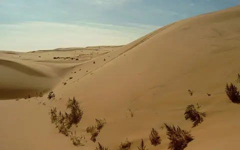

Gobi, Govi, and the area covered here
“Gobi Desert” is the established English feature name; “the Gobi” is the usual shortened form, while Govi occurs in modern Mongolian romanization and in province and place names.[1] This record covers the transboundary physical dryland on the Mongolian Plateau and adjoining northern Chinese interior. It does not treat every place containing “Gobi” or Govi as one landform, and it does not equate the desert with Mongolia's Govi-named provinces.
The “Great Gobi” is also not a synonym for the entire desert. UNESCO uses that name for a biosphere reserve in southwestern Mongolia and the Mongolian World Heritage tentative-list proposal covers specified parts of the Great and Small Gobi strictly protected areas. The proposal itself says the Mongolian Gobi can occupy as much as one-third of Mongolia depending on definition and recognizes four or five major biogeographic regions.[4][5] Protected-area coordinates and areas therefore describe those designated units, not the transboundary Gobi perimeter.
Why published areas differ
The familiar 1.3-million-km² figure and dimensions of roughly 1,600 by 1,000 km provide scale, but not a reproducible natural boundary.[2] A 2015 remote-sensing assessment found that most earlier literature did not state how the figure had been measured. Its own broader definition combined aridity, vegetation, and topography and deliberately included contiguous northern Chinese deserts such as the Tengger, Badain Jaran, Ordos, Junggar, and others.[3]
That method returned 2.229 million km² from a 1950–2000 aridity-index climatology and a 2000–2012 annual mean of 2.354 million km² from August MODIS vegetation data. Annual MODIS results ranged from 2.083 million km² in 2012 to 2.523 million km² in 2002 as precipitation and vegetation shifted.[3] Those numbers measure an arid-plus-semi-arid study region, not the same perimeter assumed by the 1.3-million-km² reference estimate. This page retains both only with their methods and scopes attached.
Topography gives the clearest hard limits in the southwest: the 2015 study used the Qilian Mountains, Kuruktag uplift, and Tian Shan to separate the Gobi from the Tarim Basin and excluded the Taklamakan despite a dry corridor between them.[3] Elsewhere the northern and eastern margins grade into steppe, so a vegetation or aridity threshold moves with the observation period. Administrative borders between Mongolia and China cross the dryland but do not define its natural edge.
Plateau basins divided by mountain belts
The Gobi occupies high continental terrain rather than a low, flat bowl. In Mongolia, the eastern and southern Gobi is generally 1,000–1,500 m above sea level, while the Mongol Altai and Gobi Altai rise mainly to 2,500–3,500 m.[1] Across the wider region, low ranges and faulted uplands divide sediment-filled depressions, so neighboring basin floors can have different outlets, rock histories, and local climates.
Gravel is characteristic, but “stony desert” does not mean an immobile sheet laid directly on one rock type. A 2019 study describes alluvial fans, playas, and wadis as the underlying landform framework and reports gravel over most of its Gobi study surface, with about 10% in mobile sand sheets, dunes, wadis, and residual hills.[8] Intermittent floods deliver mixed sediment from mountain fronts; wind removes or sorts exposed finer fractions; lag gravel becomes concentrated at the surface; and local sand accumulates where topography and wind permit.
Fans and pediments
Short mountain catchments spread coarse debris across sloping aprons; later runoff can incise older fan surfaces.
Playas and lake beds
Fine sediment and salts accumulate where internal drainage ends, creating important sources for later deflation.
Patchy dunes and sand sheets
Mobile sand occupies selected corridors and depocentres rather than forming a continuous cover across the Gobi.
No single age or origin
The Gobi is a climatic region superimposed on a geologically varied part of Asia, so it has no single bedrock age or formation event. In southwestern Mongolia, ongoing deformation associated with the far-field effects of India–Eurasia convergence is concentrated in the Altai and Gobi Altai. The Valley of Gobi Lakes between the Gobi Altai and Khangai is a long-lived sedimentary depression, and Late Cenozoic uplift and strike-slip deformation helped create its modern basin-and-range relief.[7]
Climate and tectonics then work together at the surface. Uplift supplies relief and sediment; rare floods carry gravel, sand, and silt out of valleys; closed lows preserve lake and playa deposits; and wind reworks exposed material. Along the Tuyn Gol and Orog Nuur sector, mapped Pleistocene fan surfaces are repeatedly incised, while former shorelines record lake levels above the modern lake.[7] This local sequence is an example of Gobi landscape development, not a template or age for every basin.
Separate interior catchments and mountain-fed rivers
There is no “Gobi basin” receiving all runoff. Much of the region is endorheic: water terminates within the continent rather than reaching the ocean. Some channels are brief storm flows; others carry snowmelt and rainfall from highlands into terminal lakes, playas, alluvial sediment, or groundwater. In the Valley of Gobi Lakes, the roughly 250 km Tuyn Gol flows from the Khangai side into the closed Orog Nuur Basin.[7] In northwestern China, the Heihe rises in the Qilian Mountains and crosses the Hexi Corridor toward terminal lakes in its lower Gobi reach.[9]
Modern low runoff does not mean water has always been equally scarce. In the East Gobi, digital elevation models and dated shoreline deposits identify four connected paleobasins. During Marine Isotope Stage 5, the reconstructed lakes covered about 15,500 km², reached a modeled maximum depth near 90 m, and stored about 489 km³.[10] These are reconstructed values for a former East Gobi lake system, not modern lake area or the size of the whole desert.
As those lakes contracted, exposed lake beds supplied fine sediment to wind erosion. Modern groundwater recharge is likewise spatially uneven: a five-year Mongolian model estimated diffuse recharge at only 0.3–12 mm/year across 41 sites, but its authors caution that focused recharge along rivers and depressions is not represented well by a one-dimensional soil model.[6] Springs, oases, and terminal lakes therefore depend strongly on local geology and inflow rather than on uniform rainfall over the desert floor.
Continental cold, summer rain, changing margins
The Gobi is a mid-latitude desert with cold, dry winters and warm to hot summers at lower elevations. “Cold desert” describes the winter regime; it does not imply cool summers everywhere. Distance from the oceans limits moisture, surrounding highlands alter air flow, the Siberian High dominates winter circulation, and the region lies between the westerlies and the northern reach of the East Asian summer monsoon.[3][10] A single claim that one mountain range creates the entire desert would oversimplify these controls.
Measurements show strong regional gradients. For 12 Mongolian Gobi stations, a study using 2007–2011 daily precipitation reported a spatial mean of 97 mm/year, compared with 974 mm/year of calculated grass-reference potential evapotranspiration. Their ratio gives an aridity index of 0.10.[6] In the East Gobi study area, 1970–2000 WorldClim precipitation ranged from 100 to 400 mm/year and decreased northwestward by about 60 mm per 100 km; June–August supplied roughly 60–70% of the annual total.[10] These datasets describe different places and periods, so neither is presented as a desert-wide normal.
Rain falling during the short warm season can rapidly alter vegetation at the semi-arid edge. In the 2000–2012 remote-sensing assessment, year-to-year boundary change averaged about 5%, and desert extent was correlated with summer drought conditions.[3] That is variability in a vegetation-and-aridity boundary, not evidence that the bedrock desert physically advances and retreats as one solid front.
Deflation, dust, and downwind transfer
Wind acts on sediment prepared by rivers, lake recession, frost weathering, and surface disturbance. Coarse particles may move by short hops or creep, while silt and clay can be carried far beyond the source. Gravel armor can reduce erosion once loose fines have been removed, but wadis, playas, interdunes, and disturbed surfaces continue to expose fresh sediment.
Wind-tunnel experiments on 15 intact Gobi surface samples reported 93.9% sand-sized and 6.1% loess-sized material in the transported fraction. Combined with 1960–2015 wind records from Ejin and Guaizihu in China, the authors estimated a potential surface erosion depth of 0.41–0.89 mm/year.[8] Those are experimental and modeled potentials for sampled surfaces, not a measured lowering rate for every Gobi landscape. The same work concluded that modern Gobi sources can contribute substantial sand to the adjacent Badain Jaran, while their modern contribution to the Chinese Loess Plateau had been overestimated.
Connections without merging distinct deserts
Within the Desert Hub, the Gobi is best understood as a transboundary dryland region organized by multiple basins and mountain belts. The Taklamakan Desert lies in the distinct Tarim Basin west of the Kuruktag uplift. The Ordos Desert and Badain Jaran Desert are separately named Chinese drylands that some broad Gobi mapping studies include, but their own basin boundaries, surfaces, and hydrology remain geographically useful.
This distinction resolves an apparent contradiction in the sources: “Gobi” may mean the conventional Mongolia–northern China desert, a wider arid and semi-arid region assembled for climate analysis, or a local stony surface type. Measurements are reliable only when that scope is stated.
Sources and measurement notes
- Institute of Geography and Geoecology, Mongolian Academy of Sciences, “Geographical Location, Physical Geography”, National Digital Atlas of Mongolia (2026; accessed 29 August 2026). Source for Mongolia's national relief context, the 1,000–1,500 m eastern and southern Gobi terrain, and 2,500–3,500 m Mongol Altai and Gobi Altai elevations.
- European Space Agency, “Earth from Space: ‘Waterless place’” (18 April 2008). Source for the conventional 1.3 million km² and approximately 1,600 × 1,000 km reference dimensions and a satellite-based description of gravelly basin surfaces. No boundary method or measurement date is supplied, so these are not treated as surveyed dimensions.
- Sternberg, T., Rueff, H. & Middleton, N., “Contraction of the Gobi Desert, 2000–2012”, Remote Sensing 7, 1346–1358 (2015). Source for the boundary problem; the study's inclusion of contiguous named deserts; MODIS NDVI, 1950–2000 aridity-index, topographic, and station methods; 2.229- and 2.354-million-km² results; 2002–2012 range; annual margin variability; and southwest separation from the Tarim Basin.
- Mongolian National Commission for UNESCO, “Desert Landscapes of the Mongolian Great Gobi”, World Heritage tentative-list submission 5943 (submitted 19 December 2014; accessed 29 August 2026). Source for the protected-area versus wider-desert distinction, alternative Mongolian Gobi scopes, and recognized regional variation.
- UNESCO Man and the Biosphere Programme, “Great Gobi” (accessed 29 August 2026). Source for the Great Gobi Biosphere Reserve's southwestern Mongolian location, 6,839,160 ha current record area, reference point, and 850–2,695 m elevation range. These measurements apply only to the reserve and are excluded from the desert overview cards.
- Batsukh, K., Zlotnik, V. A. & Nasta, P., “Analysis of Groundwater Recharge in Mongolian Drylands Using Composite Vadose Zone Modeling”, Frontiers in Water 4, 802208 (2022). Source for the 2007–2011 data period, 12-station Gobi means of 97 mm/year precipitation and 974 mm/year grass-reference potential evapotranspiration, aridity index 0.10, and modeled diffuse recharge limits.
- van der Wal, J. L. N. et al., “Geomorphological Evidence of Active Faulting in Low Seismicity Regions—Examples From the Valley of Gobi Lakes, Southern Mongolia”, Frontiers in Earth Science 8, 589814 (2021). Source for Gobi Altai–Khangai tectonic setting, Valley of Gobi Lakes basin history, the approximately 250 km Tuyn Gol, Orog Nuur internal drainage, alluvial-fan development, and paleoshorelines.
- Wang, X. et al., “Contributions of modern Gobi Desert to the Badain Jaran Desert and the Chinese Loess Plateau”, Scientific Reports 9, 985 (2019). Source for the gravel-dominant surface description, alluvial-fan/playa/wadi framework, 15-sample wind-tunnel work, 1960–2015 Ejin and Guaizihu wind record, transported grain-size fractions, and modeled 0.41–0.89 mm/year potential erosion depth.
- Triplett, A. & Condon, L. E., “Climate-warming-driven changes in the cryosphere and their impact on groundwater–surface-water interactions in the Heihe River basin”, Hydrology and Earth System Sciences 27, 2763–2785 (2023). Source for the Qilian headwaters, elevation and precipitation gradient, lower Gobi reach, and two terminal lakes of the Heihe basin.
- Li, H. et al., “East Gobi megalake systems reveal East Asian Monsoon dynamics over the last interglacial-glacial cycle”, Nature Communications 14, 2103 (2023). Source for modern East Gobi elevation, 1970–2000 precipitation gradient, summer rainfall share, runoff setting, four paleobasins, and the approximately 15,500 km², 90 m deep, 489 km³ MIS 5 paleolake reconstruction.