
Name, limits, and page scope
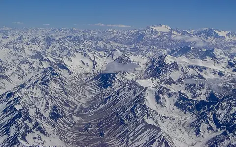
“Andes” is the English short name for the Spanish Cordillera de los Andes. This page covers the physical mountain system across Venezuela, Colombia, Ecuador, Peru, Bolivia, Chile, and Argentina; it does not treat those countries' administrative “Andean regions,” the full Pacific watershed, or every neighboring coastal range as parts of one ridge. The broad scope includes the Venezuelan and Colombian northern branches and continues through the tropical and central Andes to the Patagonian ranges and Tierra del Fuego. (Masiokas and others, 2020)
Published extents depend on those end choices. A range-wide cryosphere review uses nearly 8,000 km from about 11° N to 55° S; a meteorological review describes the continuous near-west-coast cordillera from about 10° N in Colombia to 53° S. Neither figure is a centerline survey. The U.S. Geological Survey's “over 7,000 km” South American arc is the offshore-to-onshore plate-boundary system from the Chile triple junction to the Panama fracture zone, so it is evidence for tectonic scale, not an interchangeable measurement of the named mountain range. (Masiokas and others, 2020; Garreaud, 2009; USGS, 2015)
Parallel ranges around valleys and high plateaus
The Andes are usually narrower than 200 km, but they split and broaden markedly in the central sector. In Colombia, the Western, Central, and Eastern cordilleras enclose the Cauca and Magdalena valleys. Farther south, the Central Andean Plateau forms a broad zone above the 3,000 m contour from southern Peru to northern Argentina. On that topographic definition it is about 1,800 km long and 350–400 km wide. The internally drained Altiplano and Puna basins occupy only part of this wider plateau and should not be used as synonyms for the entire Andes. (Allmendinger and others, 1997)
The same study calculated a mean plateau elevation of about 3.65 km between 13° S and 29° S, but the flatter Altiplano, higher Puna, bounding cordilleras, and isolated summits occupy different elevation bands. Aconcagua in Argentina is the range's highest summit and is identified by Argentina's space agency as the highest peak in the Americas. That agency's 2017 page uses a conventional rounded height of 6,962 m; Argentina's Instituto Geográfico Nacional gives the measured value as 6,960.8 m above mean sea level, based on GPS and gravimetric surveys in 2011 and 2012. Its public height table rounds the value to 6,961 m and locates the summit at 32°38′58″ S, 70°00′47″ W. South of about 35° S the mean crest height falls toward roughly 1,500 m, even though individual peaks still exceed 3,000 m. (CONAE, Aconcagua satellite record; IGN Argentina, Aconcagua survey; IGN Argentina, height table; Garreaud, 2009)
Subduction, shortening, and segmented volcanism
Along most of the margin the oceanic Nazca Plate descends beneath the South American Plate. The U.S. Geological Survey estimated Nazca–South America motion, relative to fixed South America, at about 65 mm per year in the north to 80 mm per year in the south for its 2015 seismotectonic synthesis. Convergence is absorbed through faulting, folding, crustal shortening, uplift, and earthquakes; water released from the descending slab helps generate magma above it. These linked processes build a cordillera, not a simple pile of volcanic cones. (Hayes and others, USGS Open-File Report 2015-1031-E)
In the Central Andes, horizontal shortening thickened continental crust and helped raise the Altiplano-Puna; magmatic addition and changes in the lower lithosphere also contributed. Geological reconstruction places the beginning of major Altiplano uplift near 25 million years ago, with Puna uplift beginning about 5–10 million years later. Those ages describe the growth of the central plateau, not the age of every Andean rock or the start of the entire cordillera. (Allmendinger and others, 1997)
Four named arcs
The Smithsonian catalog separates Northern, Central, Southern, and Austral Andean volcanic arcs rather than treating volcanism as continuous.
Flat-slab sectors
Where the subducting slab becomes shallow, active arc volcanism is absent or displaced even though crustal deformation continues.
Crustal thickening
Shortening stacked and thickened the continental crust; magmatism and deeper lithospheric change helped shape the Central Andean Plateau.
The Smithsonian's region scheme is a database classification based on volcanology, tectonics, and geography; it should not be mistaken for a universal subdivision of the entire mountain range. (Smithsonian Global Volcanism Program, volcanic regions)
The wet side reverses with latitude
Elevation cools the air and creates vertical climate belts, but latitude and wind direction decide which flank is wet. From about 5° S to 30° S, easterly flow carries Atlantic and Amazonian moisture toward the eastern slopes, while the Pacific side is comparatively cold and arid and grades into the Atacama Desert. Moist air forced upward cools and condenses—a process called orographic precipitation—while descending air dries on the lee side.
South of roughly 35° S, prevailing westerlies reverse the contrast: rain and snow are concentrated on the Chilean and western Andean slopes, while descending air produces a rain shadow toward the Patagonian Desert in Argentina. The range also becomes lower southward, so the freezing level descends and glaciers can occupy lower elevations. These are regional patterns rather than fixed rainfall values; topographic exposure, valley orientation, season, and El Niño–Southern Oscillation produce large local departures. (Garreaud, 2009)
Pacific streams, Atlantic headwaters, and closed basins
Along much of the range, water west of the main divide follows relatively short, steep routes to the Pacific. Eastward headwaters enter the Orinoco, Amazon, and La Plata systems; the last includes Andean tributaries that eventually join the Paraná. In northern Colombia, parallel cordilleras enclose the Cauca and Magdalena valleys, creating longitudinal drainage rather than a single east–west split. The divide therefore follows ridges, passes, and basin margins, not one continuous highest crest.
Runoff changes just as sharply as climate. Humid upper Amazon and Orinoco rivers commonly carry hundreds to thousands of cubic metres per second, whereas the reviewed gauges on Peru's drier Pacific side are generally in the tens; some Atacama streams cited in the same synthesis average only 0.1–2 m³/s. Those ranges summarize selected stations with different record periods, not every river. Tropical southern-Andes flows commonly peak in the December–March wet season; subtropical basins often peak with spring–summer snowmelt; Patagonian rivers combine rain, snowmelt, and glacier melt. (Arias and others, 2021)
Not all high-basin water reaches an ocean. Parts of the Altiplano are endorheic, meaning they lack a surface outlet; water is stored in lakes, wetlands, salars, and groundwater and is lost mainly by evaporation. The northern sector includes Lake Titicaca. This internal drainage is a basin property within the wider Andes, not a description of the whole mountain chain. (Arias and others, 2021)
Different cryospheres, one measured loss period
Andean ice is not one continuous cap. Small high tropical glaciers survive near the Equator; seasonal snow, debris-covered glaciers, and rock glaciers characterize parts of the dry subtropical Andes; and the wetter south contains valley glaciers and the Northern and Southern Patagonian icefields. A rock glacier is frozen, ice-rich debris that deforms slowly downslope, not simply a clean glacier hidden under loose stones. (Masiokas and others, 2020)
An Andes-wide analysis of ASTER stereo satellite imagery measured glacier change from 10° N to 56° S between 2000 and 2018. It estimated total mass loss at 22.9 ± 5.9 gigatonnes per year, equivalent to an average balance of −0.72 ± 0.22 m water equivalent per year. “Water equivalent” expresses the lost ice mass as an equivalent depth of liquid water over the measured glacier area. Patagonia had the most negative regional rate, but all three reported zones—Patagonian, tropical, and dry Andes—lost mass over the full period. These are dated geodetic estimates with stated uncertainty, not a current glacier area or a forecast. (Dussaillant and others, 2019)
Data sources and publications
- Masiokas, M. H., Rabatel, A., Rivera, A., Ruiz, L., Pitte, P., Ceballos, J. L., and others. “A Review of the Current State and Recent Changes of the Andean Cryosphere,” Frontiers in Earth Science 8 (2020), article 99. Broad 11° N–55° S scope, approximate 8,000 km extent, cryosphere regions, and recent change.
- Garreaud, R. D. “The Andes climate and weather,” Advances in Geosciences 22 (2009), 3–11. Range width and height patterns, meteorological scope, circulation, precipitation gradients, and the climatic reversal south of 35° S.
- Instituto Geográfico Nacional, Argentina. “Se dio a conocer la nueva altura oficial del Cerro Aconcagua: 6.960,8 metros” and “Alturas y Depresiones Máximas.” GPS and gravimetry campaigns conducted in 2011–2012; mean-sea-level elevation and published summit coordinates (accessed 30 August 2026).
- Comisión Nacional de Actividades Espaciales, Argentina. “Cerro Aconcagua, Mendoza—Sentinel-2A MSI—28 de Febrero de 2017.” Identification of Aconcagua as the highest peak in the Americas; the page's 6,962 m value is treated here as a rounded figure rather than a separate survey result.
- Allmendinger, R. W., Jordan, T. E., Kay, S. M., and Isacks, B. L. “The Evolution of the Altiplano-Puna Plateau of the Central Andes,” Annual Review of Earth and Planetary Sciences 25 (1997), 139–174. Plateau boundary defined by the 3 km contour, dimensions, mean elevation, crustal thickening, and uplift timing.
- Hayes, G. P., Smoczyk, G. M., Benz, H. M., Villaseñor, A., and Furlong, K. P. Seismicity of the Earth 1900–2013: Seismotectonics of South America (Nazca Plate Region), U.S. Geological Survey Open-File Report 2015-1031-E (2015), DOI 10.3133/ofr20151031E. Plate-boundary extent, convergence rates, subduction, uplift, and volcanic gaps.
- Smithsonian Institution, Global Volcanism Program. “Volcanic Regions and Region Groups,” database classification (accessed 30 August 2026). Northern, Central, Southern, and Austral Andean volcanic arcs and the scope of the region terminology.
- Arias, P. A., Garreaud, R., Poveda, G., Espinoza, J. C., Molina-Carpio, J., Masiokas, M., and others. “Hydroclimate of the Andes Part II: Hydroclimate Variability and Sub-Continental Patterns,” Frontiers in Earth Science 8 (published 2021), article 505467. Regional flow magnitudes, seasonal regimes, moisture sources, precipitation contrasts, and endorheic Altiplano hydrology.
- Dussaillant, I., Berthier, E., Brun, F., Masiokas, M., Hugonnet, R., Favier, V., and others. “Two decades of glacier mass loss along the Andes,” Nature Geoscience 12 (2019), 802–808. ASTER digital-elevation-model method and Andes-wide 2000–2018 mass-balance estimates with uncertainty.