
Range, arc, and Cascadia are not synonyms
Cascade Range is the accepted U.S. name for the mountain system; Cascades is the usual short form. In British Columbia the official feature is Cascade Mountains, which includes the Skagit, Hozameen, and Okanagan ranges. The provincial record places it south of Lytton, between the Fraser and Similkameen rivers, with the Thompson River as its northern boundary. Its official coordinate—49°44′59″ N, 121°00′04″ W (WGS 84)—marks the approximate centre of the British Columbia feature only, not the centre of the whole transboundary system. (BC Geographical Names)
The Cascade volcanic arc is the belt of subduction-related vents and intrusive bodies that overlaps the mountain system; it does not include all North Cascade crystalline terrain and should not define every range boundary. Cascadia is wider still, encompassing the offshore subduction zone, forearc, volcanic arc, and adjoining regions. This page covers the physical mountain system, not the whole tectonic margin, a watershed, or an administrative region. (USGS Pacific Northwest Geologic Mapping)
A long system with mapped sectors, not one exact length
USGS describes the Cascade mountain system as extending from northern California to central British Columbia. Its southern boundary is gradational near the Lassen volcanic region, the Klamath Mountains, Modoc Plateau, and northern end of the Sierra Nevada. Northward it crosses Oregon and Washington; at the Fraser River the North Cascades meet the Coast Mountains, while British Columbia's official Cascade Mountains feature extends north to the Thompson River. These descriptions use different but compatible boundary conventions rather than a single surveyed outline. (USGS, 2016; USGS North Cascades map)
The frequently repeated 1,200 km figure should not be treated as an exact range length. A 1983 USGS synthesis applied it to the belt of Quaternary volcanoes from northern California to southwestern British Columbia, not to a mountain centerline or polygon. Defined sectors are more reproducible: USGS gives Oregon's Cascades as 260 mi (418 km) long, as much as 90 mi (145 km) wide, and about 17,000 sq mi (44,000 km²), while its 1:200,000 North Cascades compilation defines that sector from Snoqualmie Pass northward for about 200 mi (320 km). (Duffield, 1983; Sherrod, 2016; Haugerud and Tabor, 2009)
West of the range are the Sacramento Valley, Willamette Valley, Puget Lowland, and Fraser Lowland. Eastward lie the Modoc and Klamath basins, Deschutes basin, Columbia Plateau, and interior plateaus of British Columbia. The Cascades are therefore part of the North American Cordillera, but they are physically separate from the Rocky Mountains farther inland.
Dissected western rocks, a young crest, and crystalline northern massifs
In Oregon, geologists distinguish the Western Cascades from the High Cascades. The Western Cascades are a broad belt of deformed and altered lava, pyroclastic rock, and volcaniclastic sediment, mainly late Eocene to late Miocene in age, cut into branching ridges and valleys. The High Cascades form a younger, less dissected constructional crest of lava flows, shields, cinder cones, and larger composite volcanoes. “High” and “Western” are physiographic and geologic divisions here, not simple elevation labels that apply uniformly to Washington or British Columbia. (USGS Professional Paper 449)
North of Snoqualmie Pass, the relief changes. USGS mapping shows the North Cascades dominated by erosion-resistant plutonic and metamorphic rocks rather than the mainly volcanic terrain to the south. Sharp horns, arêtes (knife-edged ridges), cirques, and deep U-shaped valleys reflect strong uplift, river incision, and repeated glaciation. Mount Rainier, Glacier Peak, and Mount Baker are younger volcanic edifices standing within or alongside this older crystalline framework; the range is not a continuous chain of volcanic cones. (USGS Scientific Investigations Map 2940)
Older and deeply dissected
Weathering, alteration, landslides, and stream erosion have lowered and divided the older volcanic belt.
Younger constructional terrain
Overlapping lava fields and vents build a broad crest punctuated by high composite volcanoes.
Crystalline alpine relief
Plutonic and metamorphic massifs form densely glaciated, sharply incised terrain.
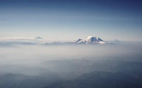
Mount Rainier is the high point, not the range centre
USGS identifies Mount Rainier in Washington as the Cascade Range's highest summit at 4,392 m (14,410 ft) and gives 46.853° N, 121.760° W for the volcano. The page does not state a vertical datum, elevation-survey edition, or horizontal datum, so this atlas retains the source's metre and foot precision and does not imply sub-metre accuracy. The figure is summit elevation, not base-to-summit relief. (USGS Mount Rainier)
A range coordinate can be especially misleading. USGS explains that GNIS coordinates for features classified as a range are placed at the highest point and use NAD 83; they do not represent a centroid or define an outline. Mount Rainier's point is useful for locating the high point, while the British Columbia coordinate above locates the approximate centre of a separately defined provincial feature. Neither can stand in for the full Cascades. (USGS GNIS guidance)
An active arc built across an older tectonic mosaic
Along the Cascadia margin, the Explorer, Juan de Fuca, and Gorda oceanic plates or plate fragments descend eastward beneath the North American Plate. Water released from the descending slab promotes melting in the overlying mantle; magma then rises through the continental crust to feed the Cascade arc. USGS reports that subduction in Cascadia has been underway for about 35 million years, while broader syntheses describe roughly 40 million years of Cascade magmatism, deformation, uplift, and erosion. These are regional histories, not the ages of today's individual cones. (USGS Cascadia database; NPS Crater Lake geodiversity atlas; USGS)
The range foundation changes along strike. Much of Oregon is volcanic: older arc deposits in the west are overlain or flanked by younger High Cascade rocks nearer the crest. In the North Cascades, accreted terranes—fault-bounded fragments originally formed in settings such as ocean floor, island arcs, and continental margins—were deformed, metamorphosed, and intruded by large magma bodies before and during later Cascade-arc activity. Erosion has exposed those deeper rocks, explaining why the northern skyline is dominated by jagged crystalline massifs even though active volcanoes occur there. (Haugerud and Tabor, 2009)
Glaciers are concentrated in the north and on the highest cones
Pleistocene valley glaciers and the Cordilleran Ice Sheet widened valleys, quarried cirques, sharpened divides, and transported sediment through the North Cascades. Farther south, alpine glaciers radiated from the largest volcanoes and high crest areas. Modern ice survives where high elevation, snow accumulation, aspect, and shading permit it, especially in northern Washington and on Mount Rainier, Mount Baker, Glacier Peak, Mount Adams, Mount Hood, and the Three Sisters.
Glacier totals require dates and size thresholds. The USGS inventory published in 1971 counted 756 North Cascade glaciers at least 0.1 km² in area, together covering 267 km²; it is a historical inventory, not a current range-wide total. NPS monitoring now reports that mapped glacier area within North Cascades National Park declined about 53% over the last century, while the Skagit receives an estimated 6–12% of its summer flow from glaciers. These park and basin estimates should not be extrapolated to the entire Cascade Range. (USGS Professional Paper 705-A; NPS Glaciers Monitoring)
South Cascade Glacier provides a dated local measurement: USGS mapped it at 1.8 km² in 2015 within a 6.14 km² headwater basin and has measured its mass balance since 1959. Annual mass balance is snow gained minus ice and snow lost, so a glacier can advance, stabilize, or retreat as winter accumulation and summer melt vary. Rockfall, landslides, streams, and volcanic deposition continue to reshape terrain beyond the ice. (USGS South Cascade Glacier)
The crest divides many basins, but the Columbia cuts across it
On the western and northern flanks, the Skagit and Nooksack reach the Salish Sea; the Puyallup and Nisqually enter Puget Sound; and the Cowlitz joins the lower Columbia. Oregon drainage includes tributaries of the Willamette and the Pacific-bound Umpqua and Rogue, while southern waters reach the Sacramento system through the Pit and upper Sacramento. East of the crest, the Okanogan, Wenatchee, Yakima, and Deschutes systems enter the Columbia basin. The divide is not unbroken: the Columbia River maintains a long-lived passage through the active volcanic arc in the Columbia River Gorge between Washington and Oregon. (O'Connor and others, 2021)
Rock permeability changes runoff timing. In the upper McKenzie basin of Oregon, young fractured High Cascade lavas and glacial deposits admit rain and snowmelt to groundwater; large springs then sustain cool, comparatively steady discharge. Older, weathered Western Cascade rocks are less permeable, so more water reaches channels quickly during storms. The USGS basin study reports that about 90% of normal precipitation falls from October through May, with mean annual precipitation rising from about 40 in (1.0 m) near Eugene to more than 125 in (3.2 m) at the crest. These figures describe the McKenzie basin, not every Cascade slope. (USGS Scientific Investigations Report 2010-5016)
Pacific storms, elevation, and a variable eastern rain shadow
Most cool-season storms approach from the Pacific. Air forced up the western slopes expands and cools, increasing rain and snow; elevation lowers temperature and keeps a larger share of winter precipitation as snow. Air descending the eastern slopes warms and dries, creating a rain shadow toward the Columbia Plateau, central Oregon, and interior British Columbia. Latitude, storm track, slope aspect, and the height and width of each sector modify that broad west-to-east pattern.
The contrast can be quantified only for a defined place and period. NPS reports average annual precipitation ranging from 76 cm in the lower Stehekin Valley to 897 cm along the Cascade crest within the North Cascades National Park Complex, whose terrain spans a wet maritime west side and a semiarid continental east side. The NPS page does not identify a normal period or station-versus-mapping method, so these values are retained only as an agency summary for that park complex, not as a range-wide normal. Seasonal snow delays runoff into spring and summer, while warm or low-snow years bring earlier melt and smaller late-season reserves. (NPS Inventory and Monitoring)
Data sources and publications
- BC Geographical Names Office. Cascade Mountains, official feature record (accessed 30 August 2026). Canadian name, included subranges, mapped boundaries, approximate-centre coordinate, and WGS 84 datum.
- Sherrod, D. R. Cascade Mountain Range in Oregon. U.S. Geological Survey, 2016. Transboundary scope, Oregon length, width and area, and subduction mechanism.
- Haugerud, R. A., and Tabor, R. W. Geologic Map of the North Cascade Range, Washington. U.S. Geological Survey Scientific Investigations Map 2940, 2009, scale 1:200,000, doi:10.3133/sim2940. North Cascades limit and length, rock framework, relief, uplift, and glaciation.
- U.S. Geological Survey. Mount Rainier (accessed 30 August 2026). Highest-summit identification, published elevation, and volcano coordinate.
- U.S. Board on Geographic Names. What is the Geographic Names Information System (GNIS)? (accessed 30 August 2026). Coordinate conventions and NAD 83 datum for GNIS range records.
- Duffield, W. A. Geologic Framework for Geothermal Energy in the Cascade Range. U.S. Geological Survey, 1983. The 1,200 km measurement and its specific definition as a Quaternary volcanic belt.
- U.S. Geological Survey. Pacific Northwest Geologic Mapping: Northern Pacific Border, Cascades and Columbia (accessed 30 August 2026). Distinction among Cascadia, the volcanic arc, and the mountain range; regional tectonic history; Columbia crossing.
- Peck, D. L., Griggs, A. B., Schlicker, H. G., Wells, F. G., and Dole, H. M. Geology of the Central and Northern Parts of the Western Cascade Range in Oregon. U.S. Geological Survey Professional Paper 449, 1964, doi:10.3133/pp449. Western and High Cascades divisions, rock ages, and dissection.
- U.S. Geological Survey. Cascadia Subduction Zone Database; National Park Service, Geodiversity Atlas—Crater Lake National Park (accessed 30 August 2026). Plate geometry and subduction of the Explorer, Juan de Fuca, and Gorda system.
- Post, A., Richardson, D., Tangborn, W. V., and Rosselot, F. L. Inventory of Glaciers in the North Cascades, Washington. U.S. Geological Survey Professional Paper 705-A, 1971, doi:10.3133/pp705A. Inventory threshold, glacier count and area.
- National Park Service. Glaciers Monitoring (updated 25 May 2023; accessed 30 August 2026); U.S. Geological Survey, South Cascade Glacier (accessed 30 August 2026). Park-scale area change, Skagit summer-flow contribution, and the dated 2015 benchmark-glacier area.
- Risley, J., Wallick, J. R., Waite, I., and Stonewall, A. Development of an Environmental Flow Framework for the McKenzie River Basin, Oregon. U.S. Geological Survey Scientific Investigations Report 2010-5016, 2010. Defined-basin precipitation, snow, permeability, springs, and runoff timing.
- O'Connor, J. E., and others. Arc versus River: The Geology of the Columbia River Gorge. Geological Society of America Field Guide 62, 2021, doi:10.1130/2021.0062(05). Columbia River passage through the Cascade volcanic arc.
- National Park Service. Inventory & Monitoring at North Cascades National Park (accessed 30 August 2026). Park elevation and precipitation gradients, maritime–continental contrast, and rain shadow.