One system, several geographic and geological meanings
“Pontic Mountains” is the English name used here for the physical ranges of northern Anatolia. Türkiye's Ministry of National Education groups the same broad relief as the Karadeniz Dağları (Black Sea Mountains), also called the Kuzey Anadolu Dağları (North Anatolian Mountains), and divides it into western, central, and eastern sectors. “Pontides,” by contrast, is a geological term for the much older orogenic belt and its crustal units. The rock belt helps explain the mountains, but it is not an exact synonym for every modern ridge or administrative Black Sea region.
This record follows the Turkish physiographic grouping: the Küre, Bolu–Ilgaz, and Köroğlu ranges in the west; the lower Canik sector in the centre; and the Gümüşhane, Rize, Mescit, and Kaçkar highlands in the east. It does not extend the landform into the Strandja Mountains of Thrace or the Lesser Caucasus merely because related geological structures continue beyond the adopted physical limits.
Lower broken ranges in the west, alpine relief in the east
A geological study describes the Pontide mountain belt as approximately 1,000 km long between the Black Sea and the Anatolian plateau. That is the best traceable order-of-magnitude figure, but the paper measures a geological belt rather than one ridge. The physical system has no universally surveyed endpoints, and its width changes as parallel chains, basins, and plateau margins enter or leave the grouping. (Rice and others, 2009)
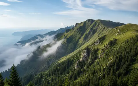
West of the Kızılırmak, the Küre, Ilgaz, Köroğlu, and Bolu ranges form separate wooded blocks with intervening depressions and river corridors. The Canik Mountains are lower and less continuous around the broad central Black Sea lowland. East of Ordu and Giresun the crest zone rises and approaches the coast; the Soğanlı, Rize, and Kaçkar massifs contain extensive terrain above 3,000 m. Kaçkar Dağı is the high point at 3,932 m above sea level. The coordinate 40.8355° N, 41.1613° E is a summit feature coordinate, not a centroid for the thousand-kilometre system. (GeoNames feature record; Bayrakdar and Özdemir, 2010)
Parallel blocks and basins
Küre, Ilgaz, Bolu, and Köroğlu are distinct ranges rather than parts of one unbroken ridge.
River-cut plateau margin
The Filyos and Kızılırmak cross actively uplifting terrain in deep bedrock gorges.
High massifs and cirques
Kaçkar and neighboring massifs hold the system's highest summits and extensive glacial landforms.
Tethyan assembly beneath a younger landscape
The geological Pontides are an east–west orogenic belt assembled along the southern margin of Eurasia. Their western, central, and eastern sectors contain different combinations of continental basement, marine sedimentary rocks, volcanic-arc successions, granitoid intrusions, metamorphic rocks, and ophiolitic material—fragments of former oceanic crust and upper mantle. The İzmir–Ankara–Erzincan suture along the southern side marks closure of a northern branch of the Neotethys Ocean and separates Pontide units from the Anatolide–Tauride and Kırşehir blocks. (Okay and others, 2013)
The eastern ranges are especially rich in magmatic rocks. An MTA geological synthesis describes Paleozoic metamorphic and granitic basement overlain by Jurassic-to-Eocene volcanic and sedimentary successions and cut by plutons of several ages. Late Cretaceous arc magmatism is linked to subduction of Neotethyan oceanic lithosphere, but the direction and timing of subduction remain debated; the page therefore does not reduce the entire system to one simple “fold-mountain” event. (General Directorate of Mineral Research and Exploration, 2022)
The active North Anatolian Fault is younger than this inherited belt and should not be described as the origin of all Pontic relief. In the central Pontides, however, field structure, channel steepness, and uplifted basin deposits connect late Neogene deformation to the fault's broad restraining bend. One study reports maximum gorge incision of about 1,400 m along the Filyos and 1,100 m along the Kızılırmak; these are local maximum incision estimates used to constrain uplift, not average valley depths for the range. (Yıldırım and others, 2011)
A patchwork of coastal, interior, and transboundary basins
Many northern catchments begin on the coast-facing slopes and descend directly to the Black Sea. The Ministry of Agriculture and Forestry defines the Eastern Black Sea basin between the Çarşamba Plain and the Kaçkar Mountains as 22,683 km², with mean annual precipitation of 1,198 mm and reported mean flow of 566.23 m³/s. Those are basin-wide agency summaries, not measurements for the entire Pontic system; the agency page does not state their averaging period. Its river map shows the closely spaced Fırtına, İyidere, Solaklı, Harşit, Aksu, and Melet networks crossing short horizontal distances but steep vertical relief. (General Directorate of Water Management, Eastern Black Sea Basin)
The crest is therefore not one continuous watershed. The Kızılırmak and Yeşilırmak collect tributaries across broad interior basins and then cut north through the mountain belt to deltas on the Black Sea. The ministry's 2021 Yeşilırmak River Basin Management Plan summary maps this interior-to-coast network independently of provincial boundaries.
The Çoruh has a third pattern. It occupies an interior corridor south of the eastern crest, flows east through Bayburt, İspir, Yusufeli, and Artvin, enters Georgia as the Chorokhi, and reaches the Black Sea south of Batumi. The Turkish Water Institute's Türkiye and Water 2025 identifies the Çoruh as a shared Türkiye–Georgia basin, while the 2020 Çoruh Flood Management Plan maps the basin's steep tributaries, elevation zones, and monitoring network. Snow storage matters most in these high eastern catchments; rainfall-driven floods and coarse sediment transport are also important on the short coastal streams.
Black Sea exposure produces a measured rain-shadow contrast
Moist air from the Black Sea is forced upward where high terrain stands close to the shore. Cooling during ascent increases cloud and precipitation on exposed slopes; air descending toward interior valleys is warmer and drier. The strength of this orographic effect varies with sector, elevation, aspect, and the width of coastal lowland, so “humid north, dry south” is a regional pattern rather than a rule for every valley.
Türkiye's Meteorological Service quantifies the eastern contrast with 1991–2020 classifications. Rize on the maritime side has a De Martonne aridity index of 71.20 and is classed “very humid”; Bayburt in the interior Çoruh basin has an index of 16.78, classed transitional between semi-arid and humid. The agency's long-record station tables reinforce the scale difference: summing its published monthly precipitation means gives about 2,292 mm/year for Rize over the displayed 1927–2025 record and 450 mm/year for Bayburt over 1959–2025. These are station summaries with different record lengths, not mountain-wide normals. (Rize classification; Bayburt classification; Rize station table; Bayburt station table)
High elevation adds a cold-season control absent from the coast. Snow persists into spring and early summer in eastern cirques and supplies delayed runoff after lower-elevation rain has already reached the sea. North-facing cirques receive less direct solar radiation and retain snow and ice more effectively than south-facing terrain; this aspect contrast helps explain why surviving glacier ice is confined to a few high eastern massifs.
Ice-age valleys and shrinking modern ice
Glacial landforms are concentrated in the Eastern Black Sea Mountains, not distributed along the full thousand-kilometre system. Around Kaçkar and Verçenik, cirques fed valley glaciers that cut U-shaped troughs and left lateral and terminal moraines, overdeepened basins, and tarns. Cosmogenic exposure dating in the Kavron Valley indicates that its Last Glacial Maximum advance continued until approximately 18.3 ± 0.9 thousand years ago. (Akçar and others, 2007)
Small modern ice bodies are remnants of that much larger glacial system and their extent is date-dependent. A satellite inventory mapped the Kaçkar glacier at about 1.8 km² in 1987 from Landsat Thematic Mapper imagery and 0.25 km² in 2011 from WorldView-2 imagery, with field checking in 2012. The authors note that debris cover caused an earlier 0.1 km² estimate to miss ice. These figures describe the Kaçkar glacier only, not all glaciers of the Eastern Pontic Mountains. (Yavaşlı, Tucker, and Melocik, 2015)
Northern rim of the Anatolian plateau
Along the coast, mountain fronts alternate with narrow alluvial strips and the much broader plains and deltas around the mouths of the Sakarya, Kızılırmak, and Yeşilırmak. Southward, the western and central ranges descend toward plateau basins; in the northeast, the high crest is separated from the interior by the Kelkit and Çoruh corridors. This arrangement controls routes, but it is the relief, drainage, and atmospheric boundary—not an administrative border—that defines the system.
Within Geography Atlas, use the Mountain Hub for range context, compare the Taurus Mountains on the southern plateau margin, or compare the higher Caucasus beyond the Black Sea's eastern end. The Pontic system is physically separate from both, even where regional geological structures continue toward neighboring orogens.
Data sources and publications
- Republic of Türkiye, Ministry of National Education, General Directorate of Special Education and Guidance Services. Coğrafya, p. 61 (accessed 30 August 2026). Turkish names, western–central–eastern grouping, and principal component ranges.
- Rice, S. P., Robertson, A. H. F., Ustaömer, T., Inan, N., and Taslı, K. “Late Cretaceous–Early Eocene tectonic development of the Tethyan suture zone in the Erzincan area, Eastern Pontides, Turkey,” Geological Magazine 146(4) (2009), 567–590, DOI 10.1017/S0016756809006360. Approximate 1,000 km geological-belt length, regional position, and suture-zone setting.
- GeoNames. “Kaçkar Dağı” feature record (record 744945; accessed 30 August 2026). Summit coordinate 40.8355° N, 41.1613° E and 3,932 m elevation.
- Bayrakdar, C., and Özdemir, H. “The effect of aspect on development of glacial and periglacial topography at the Kaçkar Mountain,” Türk Coğrafya Dergisi 54 (2010), 1–13, DOI 10.17211/tcd.95116. Kaçkar elevation and aspect controls on glacial landforms.
- Okay, A. I., Sunal, G., Sherlock, S., Altıner, D., Tüysüz, O., Kylander-Clark, A. R. C., and Aygül, M. “Early Cretaceous sedimentation and orogeny on the active margin of Eurasia: Southern Central Pontides, Turkey,” Tectonics 32 (2013), 1247–1271, DOI 10.1002/tect.20077. Geological Pontide definition, terranes, and Tethyan context.
- Revan, M. K., Göç, D., Özkan, M., Şen, C., Kara, R. T., Tokoğlu, M., Hamzaçebi, S., Sevim, R. C., Sezen, F., Bayraktar, C., and Akgül, Ö. “Geology, fluid inclusion characteristics and mineral resource estimation of the Güzelyayla porphyry Cu–Mo mineralization,” Bulletin of the Mineral Research and Exploration 169 (2022), 63–85, DOI 10.19111/bulletinofmre.1074485. The regional-geology section and map document Eastern Pontide basement, volcanic-sedimentary successions, plutons, magmatic arc, and debated subduction models.
- Yıldırım, C., Schildgen, T. F., Echtler, H., Melnick, D., and Strecker, M. R. “Late Neogene and active orogenic uplift in the Central Pontides associated with the North Anatolian Fault,” Tectonics 30 (2011), TC5005, DOI 10.1029/2010TC002756. Central Pontide uplift, fault relationship, and Filyos and Kızılırmak incision estimates.
- Republic of Türkiye, Ministry of Agriculture and Forestry, General Directorate of Water Management. “Doğu Karadeniz Havzası”; Yeşilırmak Havzası Nehir Havza Yönetim Planı summary (plan prepared 2021); and Çoruh Havzası Taşkın Yönetim Planı (2020; accessed 30 August 2026). Basin boundaries, drainage networks, eastern-basin area and hydrological summaries, and the Çoruh corridor.
- Turkish Water Institute. Türkiye and Water 2025 (2025), “Transboundary Waters.” The Çoruh/Chorokhi is identified as a shared Türkiye–Georgia basin.
- Republic of Türkiye, General Directorate of Meteorology. Rize climate classifications and Bayburt climate classifications, 1991–2020 period; Rize and Bayburt official station statistics (accessed 30 August 2026). Climate indices, classification, record periods, and monthly precipitation means.
- Akçar, N., Yavuz, V., Ivy-Ochs, S., Kubik, P. W., Vardar, M., and Schlüchter, C. “Paleoglacial records from Kavron Valley, NE Turkey: Field and cosmogenic exposure dating evidence,” Quaternary International 164–165 (2007), 170–183, DOI 10.1016/j.quaint.2006.12.020. Kaçkar glacial geomorphology and Kavron moraine chronology.
- Yavaşlı, D. D., Tucker, C. J., and Melocik, K. A. “Change in the glacier extent in Turkey during the Landsat Era,” Remote Sensing of Environment 163 (2015), 32–41, DOI 10.1016/j.rse.2015.03.002. Image dates, sensors, debris-cover correction, and mapped Kaçkar glacier change.