
A broad name, not a surveyed mountain polygon
Great Dividing Range is the accepted conventional name used by Australian mapping, water, environment, and meteorological agencies. Great Divide usually refers more specifically to the watershed crest. Eastern Highlands describes the wider elevated region, while the Great Escarpment is the discontinuous belt of steep seaward slopes. These terms overlap, but they are not interchangeable.[1][2]
This record follows Geoscience Australia's mainland convention: from the tip of Cape York Peninsula almost 4,000 km south to the Grampians in western Victoria. A peer-reviewed landscape study describes approximately 3,700 km, and the Bureau of Meteorology rounds the range to 3,500 km. None is a surveyed centreline length. The difference reflects generalized endpoints and whether “range,” “divide,” or the broader highland system is being traced; this page therefore uses about 3,700 km as an orientation figure, not a precise dimension.[1][3][7]
No single latitude and longitude can describe this multi-state linear system. The national Gazetteer represents place names with point coordinates and warns that a single point for an extensive feature is only a general indication of location. A state range point or web-map “centre” must not be presented as the centroid, midpoint, or boundary of the whole Great Dividing Range.[5]
From low northern divides to the Australian Alps
The northern system begins on Cape York Peninsula and continues through the Queensland highlands. In many places the actual water parting crosses subdued upland rather than a sharp crest. Higher massifs and volcanic plateaus can stand east of, beside, or across that line, so a map of summit ranges is not automatically a map of the continental divide.[2][3]
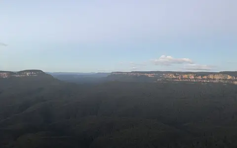
Farther south, the highlands include the New England tablelands and the dissected plateau country of eastern New South Wales. Rivers have cut gorges and broad valleys through the upland margin; the Hunter valley is a major low corridor, while the Blue Mountains are a deeply incised plateau sector rather than an isolated fold-mountain chain. In southeastern New South Wales and northeastern Victoria the relief rises into the Snowy Mountains and Victorian Alps, the highest part of the system. The highlands then turn west through central Victoria toward the Grampians.[1][3][11]
Cape York and Queensland highlands
Low watershed country alternates with separate ranges, tablelands, and volcanic uplands.
Tablelands and incised plateaus
New England and eastern New South Wales show broad upland surfaces cut by coastal rivers and gorges.
Alps to western Victoria
The Snowy Mountains and Victorian Alps contain the highest relief before the system bends toward the Grampians.
The divide and the escarpment are different features
The Great Divide is the line separating catchments. The Great Escarpment is the steeper, erosion-cut margin of the eastern plateaus. They coincide locally, including parts of southeastern Queensland and northern New South Wales, but over long sectors the watershed lies tens or even hundreds of kilometres inland. Between them are plateau surfaces, subsidiary ranges, and east-flowing headwaters. This distinction explains why the steepest visible mountain front is not always the drainage boundary.[2]
Relief is asymmetric. Coastal rivers generally have shorter, steeper routes to the Coral or Tasman Sea and have cut deeply into the eastern margin; western rivers cross much longer, gentler inland gradients. A 2017 numerical landscape study reproduced this contrast and found greater simulated erosion in east-flowing catchments, but its erosion magnitudes depend on assumed rainfall, rock erodibility, mantle flow, and model resolution. They are model outputs rather than range-wide field measurements.[3]
Mount Kosciuszko, in the Snowy Mountains of New South Wales, is the highest summit in the system at a published 2,228 m above sea level. Geoscience Australia's list is based on its 1993 National Geodetic Database combined with the National Gazetteer. Because that source gives neither the originating observation date nor a vertical datum, this page retains the established metre value but does not imply centimetre-level or modern GNSS precision.[4]
An elevated passive margin reshaped by rivers
The Great Dividing Range is not the surviving crest of one young collision zone. Its physiographic outline crosses old folded and metamorphic terranes, granites, sedimentary basins, and younger volcanic provinces. The common landform story is the development of Australia's elevated eastern continental margin and its long erosion, not one rock unit or one mountain-building event.[1][2]
After Gondwana broke apart, a broad marginal swell developed along eastern Australia. Uplift and tilting established a drainage divide, while east-flowing rivers cut back into the plateau margin to form and retreat the Great Escarpment. A peer-reviewed numerical reconstruction models two broad phases of large-scale uplift since about 120 million years ago: approximately 400–600 m from 120 to 80 million years ago, followed by later Cenozoic uplift whose timing differed from north to south. These figures describe the modelled dynamic-topography contribution; they are not direct measurements of uniform uplift along the whole range.[3]
Cenozoic volcanism added a second, local relief pattern. Successive shield volcanoes and lava fields left basalt plateaus, plugs, and caldera remnants in Queensland and New South Wales, including the Tweed, Focal Peak, Ebor, and Barrington volcanic centres. Erosion has since opened valleys through those volcanic piles and exposed older rocks beneath them. Volcanic landforms are therefore important sectors of the highlands, but volcanism did not build the entire Great Dividing Range.[9]
Several drainage divisions meet along the divide
On the seaward side, rivers drain through the North East Coast, South East Coast, and other coastal river regions toward the Coral and Tasman seas. In northern Queensland, water west of the crest reaches the Gulf of Carpentaria through systems such as the Mitchell and Flinders. Farther south and inland, different watershed sectors feed endorheic basins—basins with no ocean outlet—or the Murray–Darling river system. The Bureau of Meteorology's Geofabric maps these as separate topographic drainage divisions and river regions rather than as one “western” catchment.[6]
The Great Dividing Range forms much of the eastern and southern highland boundary of the Murray–Darling Basin. Headwaters descending inland include tributaries of the Condamine–Balonne, Border Rivers, Gwydir, Namoi, Macquarie, Lachlan, Murrumbidgee, Murray, Goulburn, and other systems. To the east, the Burdekin, Fitzroy, Brisbane, Clarence, Hunter, Hawkesbury, Shoalhaven, and Snowy systems take shorter routes toward the coast. These examples orient the drainage pattern; no single river traces the range from end to end.[6][8]
Catchment boundaries continue to change by river incision and stream capture, in which one headwater erodes through a divide and diverts part of a neighboring catchment. The 2017 model places the main divide by about 90 million years ago and simulates later local migration and reorganization. Its broad result is consistent with the modern pattern of short steep coastal catchments beside much larger inland networks, while the exact timing and amount of migration remain model-dependent.[3]
Topography modifies several climate regimes
The range spans tropical northern Queensland, subtropical and temperate tablelands, and the alpine southeast, so it does not have one climate. Onshore air can be lifted over coastal slopes and escarpments, increasing rain on exposed terrain, but the effect changes with wind direction, season, distance from the sea, and whether the escarpment and watershed coincide. In summer an inland or easterly trough commonly forms on the sheltered western side through central Queensland and New South Wales, marking a boundary between moist coastal air and hotter, drier inland air and sometimes producing inland showers and thunderstorms.[7]
Elevation produces the strongest cold-climate contrast in the Australian Alps. Winter cold fronts and low-pressure systems bring snow; persistent cover is mainly a high-elevation winter-to-mid-spring feature, while lower-level falls often melt within days. Bureau observations show that maximum snow depth, cover duration, and the number of snow days have decreased in Australian alpine regions since the late 1950s, although maximum annual depth remains highly variable and strongly affected by occasional heavy falls.[10]
Pleistocene glaciers affected only a small part of the mainland high country. Around the Kosciuszko Plateau they left cirques, moraines, glacial lakes, and periglacial landforms produced by repeated freezing and thawing. Those landforms belong to the southernmost high range; they should not be generalized to the tropical and subtropical majority of the Great Dividing Range.[1][2]
Data sources and publications
- Geoscience Australia. “Australian Landforms and their History” (accessed 30 August 2026). Cape York–Grampians scope, almost-4,000 km approximation, Great Divide drainage role, eastern-margin erosion, volcanic landforms, and Kosciuszko-area glaciation.
- Australian Heritage Council. Australian Alps National Heritage List Assessment (2008), pp. 5–6. Relationship among the Eastern Highlands, Great Dividing Range, Great Divide, and Great Escarpment; low-relief divide sectors; alpine high plains; glacial and periglacial processes.
- Salles, T., Flament, N., and Müller, D. “Influence of mantle flow on the drainage of eastern Australia since the Jurassic Period,” Geochemistry, Geophysics, Geosystems 18 (2017), 280–305, DOI 10.1002/2016GC006617. Approximate 3,700 km extent, Cape York–Grampians orientation, modelled uplift phases, drainage reversal, divide development, incision, and model limitations.
- Geoscience Australia. “Highest Mountains” (last updated 27 June 2014). Mount Kosciuszko elevation of 2,228 m; source identified as the 1993 National Geodetic Database combined with the National Gazetteer.
- Geoscience Australia. “Place Names Search,” Data / Spatial Applications (page updated 16 June 2025), and Gazetteer of Australia 2008 Release Product User Guide, pp. 17–20. Multi-jurisdiction place-name authority, GDA94 coordinate basis for that release, positional-accuracy limits, and warning that a point for an extensive feature gives only general location.
- Bureau of Meteorology. “Australian Hydrological Geospatial Fabric (Geofabric)” and Geofabric data access (version 3x services; accessed 30 August 2026). National stream network, topographic drainage divisions, river regions, water bodies, and catchment relationships.
- Bureau of Meteorology. “Easterly troughs” (accessed 30 August 2026). The Bureau's rounded 3,500 km length, lee-side trough position, summer timing, and rainfall mechanism.
- Bureau of Meteorology. “Murray–Darling Basin: Geographic information,” National Water Account 2018. Great Dividing Range boundary, highland headwater setting, named river systems, and contrast between uplands and interior plains.
- Department of Climate Change, Energy, the Environment and Water. “Gondwana Rainforests of Australia” (accessed 30 August 2026). Eastern marginal swell, erosion of the Great Divide and Great Escarpment, and the Tweed, Focal Peak, Ebor, and Barrington volcanic sequence.
- Bureau of Meteorology. “Where is the snow?” (issued 26 June 2026). Alpine and subalpine distribution, snow-producing weather systems, seasonal cover, year-to-year variability, and observed long-term snow-cover changes.
- NSW Department of Climate Change, Energy, the Environment and Water. “Greater Blue Mountains Area” (updated 5 September 2023). The deeply incised sandstone-tableland classification and Hunter Valley–Southern Highlands extent of that sector.