.jpg)
One mountain system, several working boundaries
The Pamirs are not a single crest. Geologists describe a northward-convex orocline—a mountain belt bent into an arc—between the Tajik-Afghan basin on the west and the Tarim Basin on the east. The Alai Valley separates the northern Pamir front from the southern Tian Shan; the Hindu Kush and Karakoram meet the system to the south, and the western Kunlun joins it to the east. (Schurr and others, 2014; Kelly and others, 2021)
For a reproducible map frame, a 2020 glacier study used approximately 36°35′–39°35′ N and 70°35′–75°35′ E. That perimeter includes the Kongur Shan in China and reaches the Trans-Alai sector in Kyrgyzstan, but it is a research boundary rather than a surveyed outline of a single ridge. This record uses that broad physical scope. It does not treat Tajik National Park as the whole Pamirs, and it keeps Pamir-Alay or Hissar-Alay distinct when a dataset uses that name for the neighboring northern and northwestern ranges. (Goerlich and others, 2020; Mölg and others, 2018)
Deep western incision and a high eastern interior
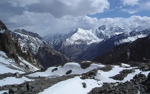
The plateau interior averages roughly 4,000 m above sea level, but its surface is not uniformly flat. East of the central ranges, wide intermontane basins and high valley floors spread between the ranges. In Tajik National Park, the IUCN reported that eastern summits commonly stand only about 1,500–1,800 m above the plateau surface; westward, the Panj and its tributaries cut narrow gorges between steep ridges, producing much greater local relief. Elevation above sea level and local relief are therefore not interchangeable measurements. (IUCN evaluation, 2013; Chen and others, 2024)
Kongur Tagh is the highest summit under the full-system boundary used by the 2020 glacier inventory, which records 7,649 m above sea level and uses names transliterated from Russian 1:500,000 topographic maps. An older 2013 IUCN evaluation printed 7,719 m for Kongur, illustrating why an elevation should be attached to its publication source rather than blended with other figures. The same IUCN document records 7,495 m Ismoil Somoni Peak as the highest summit inside Tajik National Park. The park is a 2,611,674-ha protected property in Tajikistan, not a boundary for the transboundary mountain system. (Goerlich and others, 2020; UNESCO World Heritage Centre)
Deeply dissected relief
Higher precipitation and west-flowing rivers promote incision, steep hillslopes, and active sediment transfer.
Broad high terrain
Low-precipitation basins and wide upper valleys interrupt the ranges, although the Kongur margin is sharply uplifted.
Accreted Asian crust reshaped by collision
Pamir bedrock records several episodes rather than one “formation age.” North, Central, and South Pamir belts contain fragments of continental crust, volcanic arcs, sedimentary basins, and subduction complexes accreted to Eurasia from Paleozoic through Mesozoic time. Sutures—zones where former crustal blocks were joined—separate these belts. Central Pamir magmatism includes dated Cretaceous, Eocene, and Miocene episodes, so the ages of individual intrusions cannot be used as the age of the mountain system. (Wang and others, 2021)
India-Asia convergence later shortened and thickened this assembled Asian crust and drove the Pamir northward over the former connection between the Tajik-Afghan and Tarim basins. The active Pamir thrust system folds and thrusts the northern front toward the Alai Valley; GPS studies summarized by Schurr and colleagues measure about 13–15 mm per year of shortening across that front. Within the western interior, strike-slip and normal faulting accompany east-west extension and westward spreading of high crust toward the lower Tajik-Afghan basin. Competing models differ over the geometry and fate of mantle lithosphere below the Pamir-Hindu Kush, so deep earthquakes should not be reduced to one settled slab interpretation. (Schurr and others, 2014; Kelly and others, 2021)
Several joined terranes
North, Central, and South Pamir rock belts predate the modern high topography.
Shortening and thickening
India-Asia convergence bent the belt northward and built the high plateau crust.
Faulting, rivers, and ice
Active faults raise and extend blocks while glaciers and rivers remove the resulting relief.
A dated inventory and rapidly shifting tongues
A homogeneous Landsat inventory mapped the western and eastern Pamirs around the year 2000 rather than mixing national catalogues or survey dates. In that inventory, Vanch-Yakh—labelled “Fedchenko (Vanch-Yakh)” by UNESCO and indexed as Fedchenko Glacier in the 2018 scientific inventory—covered 573 ± 19.5 km². The area excludes the touching but separately mapped Bivachny Glacier (170 ± 8.5 km²), because that tributary was in contact but not contributing ice under the inventory's entity rules. Vanch-Yakh extended from below 2,900 m to the high accumulation zone near Independence Peak, an elevation span greater than 4,000 m. These are circa-2000 plan-view areas derived from Landsat outlines, not present-day ice volume or glacier length. (UNESCO World Heritage Centre; Mölg and others, 2018)
Glacier margins do not all respond smoothly to climate. Analysis of satellite images and elevation models identified 206 distinct surges in 186 glacier bodies from 1988 to 2018, concentrated mainly in northern and western sectors. A surge transfers ice rapidly from an upper reservoir to a lower receiving zone; it can advance a terminus without indicating a positive whole-glacier mass balance. Tributary connections also change during surges, which is why glacier counts and areas depend on both date and mapping rules. (Goerlich and others, 2020)
West to the Amu Darya, east to the Tarim
In the western and central Pamirs, the Panj catchment carries flow west toward the Tajik Basin. The Bartang-Murghab, Gunt, Shahdara, Yazgulem, and Vanch are major tributary corridors; within Tajik National Park, the mapped rivers drain overwhelmingly through the Panj or the Vakhsh, which unite downstream as the Amu Darya. In the east, the Ghez and Tashkurgan catchments descend toward the closed Tarim Basin. Between them, the Karakul catchment is endorheic: its water has no outlet to the sea. (Chen and others, 2024; IUCN evaluation, 2013)
A 2024 digital-elevation-model analysis delineated approximately 79,700 km² for the Panj catchment within its Pamir study, compared with about 4,400 km² for Karakul, 9,600 km² for Ghez, and 11,600 km² for Tashkurgan. These are drainage-catchment areas, not areas of the Pamir Mountains. The same analysis found wide, low-gradient upper valleys in the dry interior and steeper, narrower lower reaches at the wetter western margin and actively uplifted Kongur margin. Tectonic structures guide many channels, while erosion has shifted the principal divide eastward over late Cenozoic time.
Westerlies weakened by successive rain shadows
Mid-latitude westerlies supply most Pamir moisture, with much of the precipitation falling in winter and spring. Relief removes moisture as air crosses the outer ranges, producing a strong decrease from the western margins toward the eastern interior. A region-wide glacier study found valley-station totals of roughly 70–300 mm per year but warned that stations undersample high accumulation zones, where snow measurements can exceed 1,000 mm water equivalent. Neither value is a Pamir-wide mean. (Mölg and others, 2018)
High elevation keeps winters long and cold, but moisture—not elevation alone—explains much of the east-west contrast. Snow and glaciers are more extensive in the wetter western massifs; cold-desert surfaces and sparse runoff dominate many eastern basins. Seasonal snow and glacier ice delay runoff into the warm season. Hydrological modelling of the greater Pamir also shows that glacier melt can partly offset dry years in strongly glacierized catchments, so shrinking ice storage can change both the amount and year-to-year variability of river flow. (Pohl and others, 2017)
Related ranges without a single shared boundary
Southward, the Afghan Wakhan highlands approach the Hindu Kush and Karakoram. Eastward, the Pamirs meet the western Kunlun Mountains along a broad transition above the Tarim Basin. The Trans-Alai range forms the active northern Pamir front south of the Alai Valley; the Tian Shan stands across that valley. “Mountain knot” is useful shorthand for this convergence of highlands, not evidence that all the neighboring ranges are one geological unit.
Pamir Mountains and the Pamirs refer here to the full physical system. Pamir Plateau is common in tectonic and geomorphic research for the high interior or the broader orogenic block. Pamir-Alay is a wider regional label whose exact content varies; it should not silently replace the boundary used for a Pamir-only measurement.
Data sources and publications
- Goerlich, F., Bolch, T., and Paul, F. “More dynamic than expected: an updated survey of surging glaciers in the Pamir.” Earth System Science Data 12 (2020), 3161–3176. Study perimeter, countries, Kongur elevation and naming convention, circa-2000 glacier inventory, and 1988–2018 surge observations.
- Mölg, N., Bolch, T., Rastner, P., Strozzi, T., and Paul, F. “A consistent glacier inventory for Karakoram and Pamir derived from Landsat data.” Earth System Science Data 10 (2018), 1807–1827. Circa-2000 outlines, entity rules and uncertainties, Fedchenko and Bivachny areas, glacier elevations, and precipitation controls.
- Schurr, B., Ratschbacher, L., Sippl, C., and others. “Seismotectonics of the Pamir.” Tectonics 33 (2014), 1501–1518. Orocline setting, neighboring basins, active faults, northern-front shortening, and contrasting eastern and western deformation.
- Kelly, S., Beaumont, C., and Butler, J. P. “Balanced cross-sections and numerical modeling of the lithospheric-scale evolution of the Hindu Kush and Pamir.” Journal of Geophysical Research: Solid Earth 126 (2021), e2020JB020678. Physical boundaries, terrane assembly, collision setting, and unresolved deep-lithosphere models.
- Wang, S., Sun, J., Qiang, X., and others. “Sedimentary provenance changes constrain the Eocene initial uplift of the Central Pamir, NW Tibetan Plateau.” Frontiers in Earth Science 9 (2021), 741194. North, Central, and South Pamir terranes, sutures, rock types, and magmatic episodes.
- Chen, S., Chevalier, M.-L., and Li, H. “Tectonic and climatic controls on topographic spatial variability across the Pamir Plateau and implications for drainage evolution.” Journal of Asian Earth Sciences 276 (2024), 106333. Plateau elevation, Panj, Karakul, Ghez, and Tashkurgan catchments, relief contrasts, and drainage-divide evolution.
- IUCN. World Heritage Nomination—Tajik National Park (Mountains of the Pamirs): IUCN Technical Evaluation, April 2013, pp. 101–107. Park boundary and area, eastern and western relief, summit elevations, climate, glaciers, lakes, and Panj–Vakhsh drainage. Measurements apply to the nominated property unless stated otherwise.
- UNESCO World Heritage Centre. Tajik National Park (Mountains of the Pamirs), inscribed 2013, accessed 30 August 2026. Property coordinates and area, physical setting, glacier and river context, and distinction between the protected property and transboundary Pamirs.
- Pohl, E., Gloaguen, R., Andermann, C., and Knoche, M. “Glacier melt buffers river runoff in the Pamir Mountains.” Water Resources Research 53 (2017), 2467–2489. Greater-Pamir hydrological model, regional precipitation differences, snow and ice melt, and flow buffering.