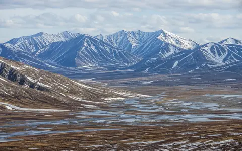
A range, a fold belt, and a wider orogen are not the same feature
Verkhoyansk Range is the English page name; Verkhoyansk Mountains is a common English alternative, and Verkhoyanskiy Khrebet transliterates the Russian Верхоянский хребет. The name refers to the mountain system, not the town or administrative district of Verkhoyansk. A TÜBİTAK Polar Encyclopedia record places the mountains within 63.03–72.38° N and 124.23–136.50° E, gives an approximately 1,100 km north–south span, and uses “Verkhoyansk Mountains.” Its coordinate limits are useful for orientation but do not define a legal or surveyed boundary. (Öztürk, TÜBİTAK Polar Encyclopedia)
A 2026 geomorphic study uses the traditional Lena-delta-to-Tompo limits and measures the range at approximately 1,200 km long and 100–250 km wide. The 100 km difference from the encyclopedia figure is rounding and boundary dependent, not a documented change in the mountains. This page follows that 1,200 km physical-geography scope: Kharaulakh in the north, Orulgan in the central sector, and the ridges approaching the Tompo in the south. It does not attach the separate Suntar-Khayata Range or all of the Verkhoyansk–Kolyma orogenic province to these dimensions, and it gives no area because the sources provide no common polygon. (Lukyanycheva and others, 2026)
Low Arctic ridges rise southward into the Orulgan highlands
The range begins near the Lena delta and Buor-Khaya Gulf with the lower Tuora-Sis and Kharaulakh ridges, then gains height in the nearly meridional Orulgan sector. South of Orulgan the structural arc bends toward the Tompo valley. The older Soviet geography description treats Sette-Daban as a southeastern continuation with different relief and geology, rather than silently extending the main-range measurements to the Sea of Okhotsk. (Great Soviet Encyclopedia, 3rd ed.)
Orulgan is the highest sector and has an asymmetric cross-profile: the Great Russian Encyclopedia describes its western slope as shorter, steeper, and more deeply cut by Lena-basin valleys, while the eastern slope is gentler and less dissected. Sharp ridges, horns, cirques, and deep glacial troughs occur in its high relief, but that Orulgan-specific description should not be generalized to every northern and southern ridge. (Great Russian Encyclopedia, Orulgan)
The high-point elevation is unresolved in the checked reference literature. The Great Russian Encyclopedia gives 2,283 m for Orulgan, the Great Soviet Encyclopedia gives 2,389 m, and the TÜBİTAK Polar Encyclopedia gives 2,409 m. None identifies the summit with a modern surveyed name, vertical datum, or measurement method. The stat card therefore reports the full published range rather than converting one value into a definitive elevation or an unsupported superlative. (Great Russian Encyclopedia, 2014; Great Soviet Encyclopedia; Öztürk)
Passive-margin sediment compressed into folds and thrust sheets
The topographic range occupies part of the much larger Verkhoyansk fold-and-thrust belt along the eastern edge of the Siberian, or North Asian, Craton. Before compression, carbonate and clastic sediment accumulated on and beyond that continental margin. In the outer western zone, exposed units span Mesoproterozoic to Mesozoic time and imbricate thrust fans stack repeated slices of rock; in the inner eastern zone, Permian and younger rocks dominate and broad parallel open folds are more typical. A thrust is a low-angle fault that places one package of rock over another during horizontal shortening. (Khudoley and Prokopiev, 2007)
Structural sections, drilling, seismic data, and thermal-maturity evidence place the start of deformation at the thrust front in the Late Jurassic, during collision between the Siberian continent and the Kolyma–Omolon superterrane farther east. Parfenov and colleagues concluded that frontal deformation ended by late Late Cretaceous time, with erosion already exposing frontal anticlines earlier in the Late Cretaceous. Their measured minimum erosion estimates vary by structural segment—about 840 m in the central Kuranakh segment, increasing to 1,500 m northward and 2,100 m southward—so they are exhumation estimates, not present relief. The same study attributed much of the modern mountain topography at the front to middle-to-late Pleistocene reactivation. (Parfenov, Prokopiev, and Gaiduk, 1995)
“Verkhoyansk Range,” “Verkhoyansk fold-and-thrust belt,” and “Verkhoyansk–Kolyma orogen” therefore describe nested but unequal things: a surface mountain system, a deformed crustal belt, and a broader regional assembly. Geological ages and widths measured for the fold belt or orogen are not automatically dimensions of the named range.
Three river systems carry runoff to the Laptev Sea
On the west, rivers including the Undyulyung and Menkere leave the Orulgan valleys for the Lena River; at the southern end, runoff entering the Tompo reaches the Aldan and then the Lena. East of the main divide, the Dulgalakh and Sartang descend from the range and join to form the Yana, while the Bytantay enters the Yana farther downstream. The Yana then crosses the Kular ridge and flows through the Yana–Indigirka Lowland to Yana Bay on the Laptev Sea. (Great Russian Encyclopedia, Yana)
The northern-eastern sector also feeds the Omoloy. Its headstream rises on the Sietinden ridge within the Verkhoyansk system, then runs north beside Kular to the Buor-Khaya Gulf. The cited Yana and Omoloy records classify both rivers as rain- and snow-fed and document long ice seasons: freeze-up begins in October, while lower Yana and the Omoloy generally open in early June. Those dates describe the named rivers, not every high-gradient tributary. Large aufeis fields occur in the upper Omoloy system—layered sheets formed when river or groundwater repeatedly overflows and freezes during winter. (Great Russian Encyclopedia, Yana, 2017; Great Russian Encyclopedia, Omoloy, 2014)
Lena system
Orulgan tributaries enter the Lena directly; southern runoff can travel through the Tompo and Aldan.
Yana system
Dulgalakh and Sartang form the Yana; Bytantay joins it below the mountain headwaters.
Omoloy system
Sietinden headwaters drain north toward the Buor-Khaya Gulf and develop extensive winter aufeis.
Continental cold, a moisture shadow, and moving frozen debris
The range is the first large northeastern Siberian barrier encountered by moisture moving from the west. A central-range glaciation study summarized a strong west-to-east gradient, with precipitation around 700 mm per year on the wetter western side and 130 mm or less east of the divide. An earlier regional synthesis, using UNESCO climatology, mapped about 250 mm per year over the eastern slope and adjoining Yana–Indigirka–Kolyma lowlands. These values describe different map areas and source compilations rather than competing range-wide station normals; the page therefore does not assign one annual precipitation value to the entire system. (Stauch and Lehmkuhl, 2010; Huh and others, 1998)
Relief also reverses the normal winter temperature gradient. Atlas climatology reported by Huh and colleagues put mean January temperature below −48°C near Verkhoyansk in the Yana basin but around −32 to −28°C on regional mountain tops, evidence of persistent cold-air pooling beneath warmer air aloft. These are historical mapped means from the 1989 Atlas of Yakutia, not a current station normal or an all-range average. Summers are short, most precipitation falls in the warmer part of the year, and continuous permafrost supports intense frost shattering and downslope movement of broken rock. (Huh and others, 1998)
High-resolution satellite mapping identified 552 rock glaciers covering 36.6 km² in the study’s Verkhoyansk boundary. A rock glacier is a tongue or lobe of frozen debris and interstitial ice that deforms slowly downslope; it is not the same as exposed glacier ice. The mapped forms extend from 654 to 2,003 m above sea level, 84% lie between 1,100 and 1,700 m, and 64% occur in cirques or on north- to northwest-facing terrain. All were classified as showing intact morphology, but field checks in that inventory were conducted in the Chersky and Suntar-Khayata ranges, so the Verkhoyansk classifications remain remote-sensing interpretations rather than direct measurements of internal ice or motion. (Lytkin, 2020)
Small modern ice, large former valley glaciers, and a revised chronology
Modern glacier ice is concentrated in Orulgan rather than spread continuously along the range. Analysis of historical inventory material and satellite images mapped 58 glaciers with a combined area of 7.47 ± 0.85 km² in 2023. Of that area, 71.8% lay between 1,700 and 2,000 m; cirque and cirque-valley forms predominated. The comparable mid-20th-century inventory, assembled from imagery dated 1951–1967, covered 16.41 km². The mapped loss to 2023 was therefore 8.94 km², or 54.5%. The uncertainty belongs to the 2023 outline, and the baseline is a date range rather than a single survey year. (Muraviev and Khromova, 2024)
The older glacial chronology is a useful example of changing evidence. Infrared-stimulated-luminescence dating published in 2010 identified five terminal-moraine sets in the central range, placed the youngest at no less than 50,000 years old, and concluded that no glacier advance occurred there during the global Last Glacial Maximum (LGM). That interpretation is no longer secure. (Stauch and Lehmkuhl, 2010)
In 2026, twelve cosmogenic 10Be exposure ages from boulders and bedrock in the western Undyulyung valley documented LGM mountain-valley ice during approximately 28,000–17,000 years ago. The reconstruction places ice more than 100 km west of the central divide and up to 300 m thick in the studied valley. A separate range study combining 28 new exposure ages with ArcticDEM mapping also found LGM ice on both flanks and deglaciation beginning after the LGM. The new chronology demonstrates extensive valley glaciation, not a continuous northeastern Siberian ice sheet; its dated transects do not yet fix the age of every moraine along the 1,200 km range. (Lukyanycheva and others, 2026, western foothills; Lukyanycheva and others, 2026, range study)
Data sources and publications
- Öztürk, M. Z. Verkhoyansk Dağları [Verkhoyansk Mountains], TÜBİTAK Polar Encyclopedia (accessed 30 August 2026). English alternative name, published coordinate bounds, 1,100 km extent, 2,409 m high-point figure, physical setting, and west–east climate gradient.
- Great Soviet Encyclopedia. Verkhoyanskiy Khrebet, 3rd edition (1969–1978; online transcription accessed 30 August 2026). Lena-delta-to-Tompo scope, width, sector sequence, drainage divide, 2,389 m high-point figure, and distinction from Sette-Daban.
- Great Russian Encyclopedia. Orulgan, vol. 24 (2014), p. 487. Orulgan extent, 2,283 m elevation, west–east slope asymmetry, glacial relief, and vegetation belts.
- Khudoley, A. K., and Prokopiev, A. V. “Defining the eastern boundary of the North Asian craton from structural and subsidence history studies of the Verkhoyansk fold-and-thrust belt,” Geological Society of America Special Paper 433 (2007), 391–410. Outer and inner structural zones, exposed succession, passive-margin subsidence, and cratonic boundary interpretation.
- Parfenov, L. M., Prokopiev, A. V., and Gaiduk, V. V. “Cretaceous frontal thrusts of the Verkhoyansk fold belt, eastern Siberia,” Tectonics 14.2 (1995), 342–358. Cross sections, deformation chronology, collision setting, segment-specific erosion estimates, and Pleistocene reactivation.
- Great Russian Encyclopedia. Yana, vol. 35 (2017), p. 709. Dulgalakh–Sartang confluence, Bytantay tributary, Kular crossing, Laptev Sea outlet, runoff sources, and ice season.
- Great Russian Encyclopedia. Omoloy, vol. 24 (2014), p. 176. Sietinden source, Kular relationship, Buor-Khaya outlet, runoff sources, ice season, and upper-basin aufeis.
- Huh, Y., Panteleyev, G., Babich, D., Zaitsev, A., and Edmond, J. M. “The fluvial geochemistry of the rivers of Eastern Siberia: II. Tributaries of the Lena, Omoloy, Yana, Indigirka, Kolyma, and Anadyr draining the collisional/accretionary zone of the Verkhoyansk and Cherskiy ranges,” Geochimica et Cosmochimica Acta 62 (1998), 2053–2075. Regional drainage, historical temperature and precipitation climatology, inversion setting, and sedimentary bedrock.
- Stauch, G., and Lehmkuhl, F. “Quaternary glaciations in the Verkhoyansk Mountains, Northeast Siberia,” Quaternary Research 74.1 (2010), 145–155. Central-range precipitation gradient, five-moraine mapping, infrared-stimulated-luminescence ages, and the earlier no-LGM interpretation.
- Lytkin, V. “Inventory and Distribution of Rock Glaciers in Northeastern Yakutia,” Land 9.10 (2020), 384. Satellite and DEM method, Verkhoyansk inventory boundary, count, area, elevations, aspect, morphology, and field-validation limits.
- Muraviev, A. Y., and Khromova, T. E. “Reduction of glaciers in the Orulgan Range (Verkhoyansk Range) from 1951 to 2023,” Ice and Snow 64.4 (2024), 513–526. Historical baseline, 2013–2023 satellite mapping, 2023 glacier count and area uncertainty, elevation distribution, morphology, and dated area change.
- Lukyanycheva, M. S., Vasilieva, A. N., Lytkin, V. M., and Kurbanov, R. N. “Glaciation of the Western Foothills of the Verkhoyansk Range During the Last Glacial Maximum (LGM),” Ice and Snow 66.1 (2026), 138–154. Twelve 10Be exposure ages, Undyulyung valley reconstruction, LGM interval, western extent, and modeled ice thickness.
- Lukyanycheva, M. S., Kurbanov, R. N., Jansen, J. D., and others. “Extensive glaciation of the Verkhoyansk Range, northeastern Siberia, during the Last Glacial Maximum,” Quaternary Science Reviews 381 (2026), 109954. Range dimensions, ArcticDEM landform mapping, 28 10Be exposure ages, both-flank LGM extent, and deglaciation chronology.