
A desert region, not a park or watershed
Mojave Desert is the accepted English name; the Library of Congress treats Mohave Desert as a variant leading to that heading.[1] “Mojave Basin and Range” is the corresponding Level III ecological-map name used here for a consistent boundary. It is not an alias for Mojave National Preserve, which covers one part of eastern California, nor for the Mojave River watershed or the larger Basin and Range geologic province.
A desert boundary is a mapped transition, not a surveyed property line. A 2006 scientific review compared several delineations and reported 114,478–130,464 km², explicitly making the result definition-dependent.[3] The CEC description used for this page supplies a mapped ecological frame but no area total. This page therefore does not average competing polygons or present one area as exact, and it does not assign a single latitude–longitude point to an extensive region.
Between mountain barriers and neighboring deserts
The Mojave extends across southeastern California and southern Nevada into northwestern Arizona and southwestern Utah. Its western side lies east of the southern Sierra Nevada and Tehachapi highlands; the San Gabriel and San Bernardino Mountains form the southwestern mountain front. Northward, Mojave lowlands and uplands grade into colder Great Basin terrain. Southward, the transition is toward the Sonoran Desert, including the Colorado Desert subdivision in southeastern California.[2]
The eastern limit is not simply the California–Arizona border. CEC mapping carries the ecoregion through southern Nevada, northwestern Arizona, and the southwest corner of Utah, while the Colorado Plateau rises to the east. Likewise, state lines cross basins and ranges without defining their physical edges. The useful boundary clues are changes in elevation, temperature, precipitation season, substrate, and characteristic desert plant communities, not jurisdiction alone.[2]
Basins built by tectonics, filled by erosion
The Mojave occupies the southwestern part of the Basin and Range topographic system. Cenozoic crustal extension and basin formation helped produce uplifted blocks beside subsiding valleys, but the fault pattern is not uniform. In the northern and central California Mojave, active deformation is also distributed through the Eastern California Shear Zone, where strike-slip and oblique faults overprint the extensional framework. USGS mapping emphasizes that tectonic uplift, erosion, basin fill, and active deformation continue to shape both relief and groundwater-basin geometry.[5]
Weathering breaks rock on mountain slopes; short, steep channels move debris to canyon mouths; and the sudden loss of gradient spreads gravel, sand, and mud into an alluvial fan. Adjacent fans merge into a bajada, or continuous piedmont apron. Coarse sediment tends to remain near the range front, while finer material reaches valley lows. A playa is the flat floor of a closed basin where temporary water, mud, and dissolved salts collect before evaporation or infiltration. USGS work in Mojave National Preserve shows how bedrock, fault geometry, uplift, subsidence, weathering, and climate jointly control these surfaces.[4]
The regional vertical range is not an abstract statistic. At Death Valley, NPS gives Badwater Basin as −282 ft (−86 m) and Telescope Peak in the adjacent Panamint Range as 11,049 ft (3,368 m), a vertical difference of 11,331 ft (3,454 m).[10] CEC rounds the region-wide low to −85 m and the upper envelope to more than 3,300 m. At the precision reported, the low-point values are consistent; neither summary identifies a distinct vertical datum.[2]
Bedrock to fan
Rockfall, weathering, and storm runoff supply angular debris to short channels and fan heads.
Fan to bajada
Repeated floods shift channels and sort sediment downslope across coalescing alluvial aprons.
Wash to playa
Fine sediment and salts reach the lowest closed surface, which may flood briefly and then dry.
Fans, lake beds, and dunes remain mobile
Mojave surfaces respond differently to storms. Field dating and sediment records indicate that cool-season Pacific frontal storms favor river flow, temporary lakes, and fan incision, whereas intense warm-season storms can drive hillslope erosion and fan aggradation—the buildup of sediment on a fan. The same study identified regionally recurring aggradation intervals at about 14–9 and 6–3 thousand calibrated years ago; those are dated episodes in a changing landscape, not an “age of the desert.”[8]
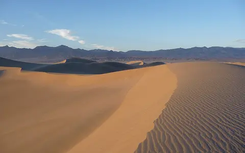
Sand dunes occupy only selected sediment traps. At Kelso, a 2017 mineralogical and geochemical study mapped a dune field of about 100 km², including about 40 km² of active dunes. Its sand is not from one source: Mojave River and Budweiser Wash alluvium contribute to western groups, while reworked Providence Mountains fan sediment is important in the east.[9] That measured dune field must not be confused with the area of the Mojave Desert.
Mostly episodic flow, with two contrasting river systems
Many Mojave basins are internally drained: storm water runs down washes, spreads across fans, infiltrates basin fill, or ends on a playa. The desert as a whole is not one endorheic basin, however. The Colorado River crosses the eastern ecoregion and carries water from a distant, much larger watershed.[2] Treating every dry valley as part of one drainage system would confuse ecological extent with watershed boundaries.
The Mojave River shows the opposite pattern on a regional scale. A 2024 USGS report traces it about 180 km from the San Bernardino and San Gabriel Mountains, through the Victorville area and Afton Canyon, to Soda Lake. The channel is typically dry along most of that course; the report gives surface-flow recurrence averaging once every 5–7 years, while groundwater discharge sustains perennial reaches near Victorville and in Afton Canyon. Its permeable floodplain deposits form a productive aquifer, and river flow is an important recharge source.[6] Those measurements describe the Mojave River system in western San Bernardino County, not desert-wide drainage.
Mountain springs are another local expression of stored water. In Mojave National Preserve, inventories conducted mainly in 2002–2004 identified more than 240 spring- and seep-associated sites, concentrated along the Granite–Providence–New York–Castle mountain spine. NPS describes many as discharges from perched aquifers recharged by local rain and snowmelt; flows can weaken or cease during multiyear drought.[11] The count belongs to the 1.6-million-acre preserve and is not a census of the full desert.
Pacific winters, eastern summer storms, and elevation
CEC classifies the mapped Mojave Basin and Range as a dry subtropical desert. Its 2011 synthesis reports a mean annual temperature near 24°C in the lowest basins and about 5°C at high elevations, together with mean annual precipitation of 167 mm and a range from 50 mm in the driest terrain to more than 900 mm on wet high peaks.[2] These are spatial summaries across the mapped ecoregion. Because the report does not identify an averaging period for them, they should not be read as current 30-year climate normals.
Moisture seasonality changes across the desert. Pacific frontal systems supply widespread cool-season precipitation, while summer convection and monsoonal incursions become more important toward the east. A 2020 NPS synthesis maps summer precipitation as common in the eastern Mojave but markedly decreasing westward; it also shows the East Mojave Highlands around the Clark and New York Mountains and Cima Dome receiving more precipitation than surrounding lowlands.[7] Elevation therefore modifies both temperature and water supply over short horizontal distances, and winter snow can occur on mountain terrain even though low basins are warm desert.
Rainfall is not only a climate statistic: season, intensity, and antecedent moisture determine whether water infiltrates, cuts a fan channel, moves coarse debris, or ponds on a playa. Long dry intervals stabilize or expose surfaces; rare storms can reorganize them in hours. The Mojave is consequently a process-driven mosaic of old pavements, young channels, reworked fans, temporary lakes, and windblown sediment rather than a static sheet of sand.[4][8]
Follow the boundaries by process
Compare the Mojave's warm basins and mixed winter–summer precipitation with the colder Great Basin Desert to the north and the lower Sonoran Desert to the south. The Sierra Nevada record supplies western mountain context, while the Colorado River page follows the through-flowing system that crosses the desert's eastern side. Return to the Desert Hub for other dryland regions.
Sources and measurement notes
- Library of Congress, Library of Congress Subject Headings, section M, 43rd edition (2021; accessed 29 August 2026). The authorized heading is “Mojave Desert”; “Mohave Desert” is a variant heading.
- Wiken, E., Jiménez Nava, F. & Griffith, G., Commission for Environmental Cooperation, North American Terrestrial Ecoregions—Level III (2011), section 10.2.1, pp. 91–92. Source for the Mojave Basin and Range map frame, four-state location, warm-desert classification, neighboring vegetation regions, elevation, precipitation, temperature, terrain, and Colorado River context. The report does not state the climate averaging period.
- Berry, K. H., Murphy, R. W., Mack, J. S. & Quillman, W., “Introduction to the special issue on the changing Mojave Desert”, Journal of Arid Environments 67, 5–10 (2006). The 114,478–130,464 km² interval synthesizes multiple published definitions; it is retained as evidence of boundary dependence, not as an exact area.
- Stoffer, P. W., U.S. Geological Survey, Desert Landforms and Surface Processes in the Mojave National Preserve and Vicinity, Open-File Report 2004-1007 (2004). Used for the linked roles of tectonics, bedrock, weathering, erosion, stream channels, fans, playas, dunes, uplift, and subsidence; examples are local to the preserve and vicinity.
- U.S. Geological Survey, Geology, Minerals, Energy, and Geophysics Science Center, “Western Basin & Range—Eastern California Shear Zone” (project page published 18 July 2019; accessed 29 August 2026). Source for Cenozoic extension, basin formation, active deformation, erosion, tectonic uplift, and groundwater-basin mapping in the northern and central Mojave.
- Groover, K. D., Fram, M. S. & Levy, Z. F., U.S. Geological Survey, Status and Understanding of Groundwater Quality in the Mojave Basin Domestic-Supply Aquifer Study Unit, 2018, Scientific Investigations Report 2024-5019 (2024). Source for the approximately 180 km Mojave River course, typical dry reaches, 5–7-year surface-flow recurrence, perennial groundwater-discharge reaches, floodplain aquifer, and recharge; its study unit is not the Mojave Desert boundary.
- National Park Service and Sweeney Granite Mountains Desert Research Center, Mojave National Preserve Science Newsletter 2020, pp. 1–2. Used for the west–east and elevation-related precipitation gradients and the East Mojave Highlands cross-section; the precipitation map represents modeled 1961–1990 averages.
- Miller, D. M. et al., “Holocene landscape response to seasonality of storms in the Mojave Desert”, Quaternary International 215, 45–61 (2010). Used for dated fan-aggradation intervals and the differing geomorphic effects of cool- and warm-season storms.
- Muhs, D. R., Lancaster, N. & Skipp, G. L., “Geochemical evidence for a complex origin for the Kelso dunes, Mojave National Preserve, California, USA”, Geomorphology 276, 222–243 (2017). Source for the approximately 100 km² dune field, approximately 40 km² active-dune area, sampled dune groups, and multiple sediment sources.
- U.S. National Park Service, “Telescope Peak”, Death Valley National Park (updated 4 August 2025; accessed 29 August 2026). Source for the 11,049 ft/3,368 m summit, −282 ft/−86 m Badwater Basin, and 11,331 ft/3,454 m vertical difference.
- U.S. National Park Service, “Springs & Seeps: Introduction”, Mojave National Preserve (accessed 29 August 2026). Source for spring locations, perched-aquifer recharge, seasonal and multiyear variability, and the preserve-scoped inventory of more than 240 associated sites.