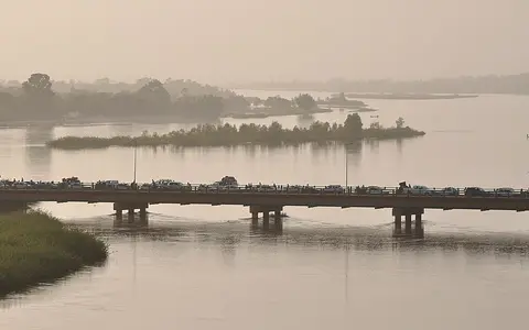
.jpg)
What the Niger River is
The Niger is the principal river of western Africa. Its main stem crosses or borders Guinea, Mali, Niger, Benin, and Nigeria, while its drainage basin also reaches parts of several neighboring countries. The river does not follow a direct route from source to sea: it first runs away from the nearby Atlantic coast and deep into the continental interior.
This sweeping course is central to its physical geography. The river links wet headwaters to the seasonally dry Sahel, loses and stores water across broad inland floodplains, receives major tributaries farther downstream, and finally divides into a dense distributary network on the Gulf of Guinea coast.
From the Guinea Highlands into the Sahel
The upper Niger rises in upland terrain near the Guinea–Sierra Leone border, only a few hundred kilometres from the Atlantic. Watersheds and regional slope direct it northeast, however, through the interior of Guinea and toward Mali. Tributaries descending from the Fouta Djallon and neighboring uplands add runoff to the upper system.
Beyond the upper valleys, gradients ease and the river enters broad plains. It passes the Bamako region and continues toward the low-lying basin around Ségou, Mopti, and Timbuktu. Near the northernmost part of its arc, the channel lies along the southern margin of the Sahara before turning east and then southeast through Niger and toward Nigeria.
Flood spreading across an interior basin
In central Mali, the Niger and Bani rivers enter a shallow, low-gradient depression known as the Inner Niger Delta. Here the river divides among channels, lakes, flood basins, levees, and seasonally inundated plains rather than reaching the sea. The area expands greatly during the annual flood and contracts as water returns to the channels, evaporates, or is stored in soils and shallow basins.
The flood arrives after rainfall in the wetter upper catchment, so high water can move across the inland delta after local rains have diminished. This delayed pulse makes upstream runoff, channel slope, floodplain storage, and high evaporation all important controls on downstream flow.
Highland runoff
Humid uplands in Guinea supply the headwaters and much of the upper river's seasonal flood.
Inland floodplain storage
The Inner Niger Delta spreads water across channels, lakes, and seasonally flooded plains.
Tributaries and coastal delta
Downstream inflows rebuild discharge before the river divides near the Gulf of Guinea.
Rainfall gradients and tributary inputs
The basin spans a strong climate gradient. The Guinea Highlands receive abundant seasonal rainfall, while the middle river crosses the drier Sahel, where precipitation is lower, evaporation is high, and many local watercourses are intermittent. The timing and size of the Niger's flood therefore reflect rainfall far upstream as well as water retained across the inland delta.
Farther southeast, tributaries increase the main river's flow. The Benue is the largest of these and joins the Niger at Lokoja after draining uplands and plains to the east. Other important tributaries include the Bani in Mali, the Sokoto system from the northwest, and the Kaduna from central Nigeria. Their different catchments give the lower Niger a combined flow regime rather than a single uniform seasonal pulse.
Low gradients, confined reaches, and alluvial plains
Much of the middle Niger occupies gently sloping terrain, favoring meanders, branching channels, floodplain deposition, and wide zones of seasonal inundation. Rockier or more confined reaches interrupt this pattern where the river crosses uplands and resistant bedrock, while broad alluvial valleys return downstream.
Sediment is eroded from headwaters and tributary catchments, temporarily stored on inland floodplains, and reworked along the lower river. The balance between transport and deposition changes with channel slope, flood stage, bank material, and tributary contribution. This repeated storage and release helps build levees, bars, flood basins, and delta plains.
The Niger Delta and Gulf of Guinea
Below the Niger–Benue confluence, the river crosses southern Nigeria toward a broad coastal lowland. Near the head of the Niger Delta, the main channel separates into distributaries that carry water and sediment through a low-relief plain of natural levees, backswamps, tidal channels, and estuaries.
The coastal delta differs from the Inner Niger Delta: it is a true river-mouth system connected to the Atlantic, influenced downstream by tides and the Gulf of Guinea. Together the two delta landscapes frame the river's geography—one an inland zone of seasonal flood dispersal, the other the final transition from continental drainage to the sea.